Travel Bucket List: India – Chattisgarh Part 2

Bhilai and Durg
Known as twin cities, Bhilai and Durg are approximately about 32 km and 50 km west of Raipur. With a population exceeding 1 million, Bhilai is the second-largest urban area in Chhattisgarh after Raipur as well as a major industrial city and an education hub of central India. Durg lies east of the Shivnath River and is part of the Durg-Bhilai urban agglomeration and is the headquarters of the Durg District. Bhilai is home to several industries as well as the Indian Institute of Technology Bhilai. The Jama Masjid in Bhilai is one of the largest mosques in India and the state’s oldest zoo, Maitri Bagh lies in Bhilai.

It is believed that Bhilai is derived from the Bhil tribe which originally inhabited this region and continues to dwell in the nearby forests even today. The Bhilai word means the Bhils arrived. Bhilai was a small village and a part of the Haihaiyavansi Kingdom until 1740 when it was conquered by the Marathas. The foundation of the modern city of Bhilai was laid in 1955 when the Indian government signed a historic agreement with the Soviet Union in Magnitogorsk to establish a steel plant near the village. The first blast furnace of the plant was commissioned in 1959 by the first President of India, Dr Rajendra Prasad. The number of steel rails produced by the facility till 2007 can go around the circumference of the earth 7.5 times and this is depicted on the monument at Globe Square in the heart of the city. The facility underwent modernization and expansion and is amongst the leading manufacturers of iron and steel in Asia.

An ancient fort and a temple, Dhamdha is located nearly 35 km from Bhilai on the way to Bemetara. There are several restaurants and hotels for overnight stays, should one want to do that. Lying 60 km from Bhilai, Tandula is known for a man-made dam built over the Tandula River. Serving as a perfect picnic spot, this place is flocked by tourists, especially during winters. The Irrigation department has guest houses for visitors to stay overnight. About 100 km from Bhilai, amid a dense forest, tunnels and hills, Hajra Falls offers a spectacular view falling from a height of 150 m. Famous as a picnic spot among locals as well as tourists, one can also find accommodation in form of a Forest Bungalow.

Maitri Bagh, which translates to a Garden of Friendship, is a zoo cum park that caters to both adults and children. It is the biggest zoo in the region and offers a wide array of options for entertainment. Maitri Bagh was established as a symbol of friendship between the USSR and India, in 1972 and was developed by the Bhilai Steel Plant and the Steel Authority of India Ltd. The entrance to the zoo has a pair of giraffes that welcome visitors. The zoo is spread over an area of about 167 acres and is home to about 39 species of animals, birds and reptiles, including some endangered species with the white tiger the main attraction of the zoo. There is a musical fountain situated on the island in the artificial lake of Maitri Bagh and is lit in colour during the show that takes place each night. There is a toy train called Maitrey Express that covers the entire zoo and is a hit among children. There is also a flower show held annually. The entry fee to the Maitri Bagh Zoo is INR 20 for Indian nationals and INR 10 for Indian children while adult foreigners need to pay INR 20 and their children can enter free. Maitri Bagh remains closed on all Mondays while on other days, the zoo is open between 10 am to 5 pm while the park is open between 10 am to 7:30 pm and the musical fountain takes place from 7 pm onwards only on Saturdays and Sundays. The operating hours of the toy train ride are from 3 pm to 6 pm on the days Maitri Bagh is open. Guides are available on request.

Lying amid a picturesque location, Siyadevi is known for its Sita Maiya Temple. And for those visiting between July and February, one can enjoy the beautiful views of the natural waterfall. Named after the devout wife of Lord Ram, Goddess Sita, Siyadevi is believed to be one of the places where Lord Ram, Lord Laxman and Goddess Sita lived during their vanvaas or exile. Housing an ancient Shiva Temple, Deobalod is situated about 3 km from Bhilai. Located about 60 km from Bhilai, the Ganga Maiya Temple at Jhalmala has a very interesting legend attached to it. According to the legend, a local fisherman found the deity of the temple in his net but ignored it instead of recovering it. Later, a villager from the same village had a dream in which the idol ordered the person to retrieve and keep it in a hut near the village. Sometime later, a temple was established there by Bhikam Chanda Tiwari.

Source

Situated on the bank of river Sheonath, amidst entrancing natural scenery, the Uwasaggharam Parshwa Teerth is the shrine of the 23rd Teerthankar Lord Shri Parshwanath and commemorates his visit to this region about 3000 years ago as a Shraman or a wandering mendicant dedicated to self-realization through self-sacrifice. Founded in 1995, the temple is also home to a garden, temples, a Yoga centre and a guest house all built on the banks of the River Sheonath. The entrance to the resplendent marble temple of Shri Parshwanath is through a 30 feet gate that has the idol of Parshwanath, supported by four pillars representing the four essentials of spiritual atonement, wisdom, introspection, good conduct and penance, being worshipped by two elephants. Sacred water or amiya, oozes from the idol here and hundreds of pilgrims visit this shrine on the day of the full moon.

Rajnandgaon
Located about 72 km west of Raipur, the district of Rajnandgaon came into existence on 26 January 1973, as a result of the division of the Durg district. Originally known as Nandgram, Rajnandgaon State was ruled by the Somvanshis, the Kalachuris of Tripuri and the Marathas. The palaces in the town showcase tales of the rulers, their society and culture, and their traditions.

The city was ruled by a dynasty of Hindu caretakers or Bairagis, who bore the title Vaishnav and Gond rajas or chiefs. Succession was by adoption and the foundation of the dynasty is traced to a religious celibate who came from Punjab towards the end of the 18th century. From the founder, it passed through a succession of chosen disciples until 1879 when the British government recognised the ruler as a hereditary chief and it came to be known as the princely state of Raj Nandgaon and the heir was conferred the title of Raja Bahadur. The first ruler Mahant Ghasi Das was recognised as a feudal chief by the British government in 1865 and was granted a letter of adoption. Later the British conferred the title of Raja on the ruling mahant.

In ancient times Rajnandgaon, like the rest of the Chhattisgarh plain, was part of Dakshina Kosala and part of the Mauryan empire during Emperor Ashoka’s time. Coins of the Indo-Sassanians have been found near Rajnandgaon dating from the 3rd century, implying the region had indirect contact with the rest of the world. In the 4th century, Dakshina Kosala was one of the regions which were subdued by Samudra Gupta on his southern expedition. However it was unlikely the Guptas ever directly controlled this territory south of the Mahanadi, rather the local rulers acknowledged Gupta overlordship. Gupta coins have been found in Dakshina Kosala. Parts of the region were controlled by the Nalas of Bastar at times, while other areas were controlled by the Vakatakas for periods in the 5th century. In the 6th century, the area was under the control of the Somavamshis while it fell back into Nala hands in the 7th century. In the 10th century, the Somavamshis returned to power, but were soon overthrown by the Kalachuris, who claimed Haihaiya origin. In the 12th and 13th centuries, the southern part of the district fell into the control of chieftains from Kanker. The Kalachuris or Haihaiyavansis continued ruling the district until the 18th century. Khairagarh and the northern part of the district were ruled by the Raj Gonds of Garha-Mandla. After the struggle of Rani Durgavati, these rulers, as well as the Kalachuris of Raipur who ruled the southern part of the district, became vassals of the Mughals. In 1742, the Marathas under the Bhonsles of Nagpur invaded Chhattisgarh and quickly overthrew the last king of the Haihaiyavansis and took over what is now Rajnandagaon district. In 1753, the Bhonsles of Nagpur confiscated all the territory that is now Chhattisgarh, and Raghoji gave the area to his son, Bimbaji, who ruled it virtually independently. The territory continued to be controlled by the Marathas until the Third Anglo-Maratha War when it fell into British hands who then returned the territory to Maratha hands. Until 1836 it was administered by a series of subadars obedient to the Nagpur state. In 1853, Nagpur was annexed by the British under the Doctrine of Lapse and Rajnandgaon fell under direct British administration under the Central Provinces and Berar. Rajnandgaon remained a Princely State in independent India and in 1948, was merged into the Durg District of Madhya Bharat, later Madhya Pradesh. Rajnandgaon district was carved out from the erstwhile Durg district on 26 January 1973. Later, Kabirdham district was carved out from this district on 1 July 1998. Rajnandgaon is a part of the Red Corridor.

Situated on a hilltop at a height of about 490 m about 26 km from Rajnandgaon, is a significant religious site. Also referred to as Badi Bambleshwari, the temple is located in Dongargarh and is half a km from the main temple complex at the foot of the hill known as Chotti Bambleshwari. Thousands of devotees from in and around Chhattisgarh flock to the shrine during the ten days of Navratri in September and October as well as during Ramnavmi in April. During this time, fairs which are run 24 hours are organised in the temple premises. It is said that about 2,220 years ago, a local king, Raja Veersen performed several Pujas and worshipped the gods to be blessed by an offspring. When after a year, the queen gave birth to a son, the king who believed it to be a blessing from Lord Shiva and Parvati, constructed the temple here.

Another site of interest is the ancient place of Mata Sheetala Devi Shakti Peetha. This temple, which is more than 2200 years old, lies 1.5 km from the railway station. Pragyagiri, a famous Buddhist Vihara is another attraction as is Barfani Dham where pilgrims throng. Other places of interest are Ambagarh Chowki, Ambagarh Devi Mandir, Mongara Dem and Sankar Dahara Tipagarh Pahadi.

Chirmiri
Chirmiri is a hill station about 298 km north of Raipur and not far from its border with Madhya Pradesh. It was a part of the Koriya district until 15 August 2021 when the separate Manendragarh-Chirmiri-Bharatpur district was created. Chirmiri is known for its coal extraction as the area is rich in coal. Chirimiri is referred to as the Heaven of Chhattisgarh due to its lush greenery, mountains, and rivers that make it a perfect getaway destination. There are several temples and other places famous among tourists. Located at an altitude of 579 m above sea level, Chirimiri lies along the banks of the Hasdeo River, one of the most prominent tributaries of the Mahanadi River. Chirmiri’s weather is pleasant all year round, and there are dense forests in the region housing exotic flora and fauna. The best time to visit Chirmiri is March just in time to celebrate Shivratri with the locals. It is one of the most popular festivals in the region. Otherwise, the monsoon season between October to April is when the city is clean and green with the dirt and grime washed away.

One of the chief tourist attractions of the region is the Lord Jagannath Temple which is a replica of the Jagannath temple in Puri, Odisha. The Kalibadi Temple is located in Haldibadi on a hill and is very close to the main train station. Baigapara is a temple located in Bartunga where there is also an ancient Sati temple dedicated to the Goddess Sati. The Gufa Mandir is located in Godaripara while the Maha Maya Temple in Ratanpur is one of the 52 Shakthi Peeths, and is dedicated to Goddess Lakshmi and Goddess Saraswati. The temple was built by the Kalachuri King Ratnadeva in the 12th or 13th century. The architecture is of the Nagara art, facing north with a big water tank. There are also temples dedicated to Lord Shiva and Lord Hanuman respectively on the premises. The oldest temple here, built in 1039 is a temple dedicated to Kantideval and is said to be constructed by an ascetic known as Santhosh Giri. The temple is guarded by Kalabhairava residing in another temple on the approach road. There are also ruins of an 11th-century Kadaeideol Shiva temple on a hilltop near a fort.

17 km from Chirmiri lie Amrit Dhara Falls which are located in Barbaspur. There is a famous temple dedicated to Lord Shiva near the waterfalls. The falls are also a favourite picnic spot for locals. Apart from being a famous waterfall, the place is used for picnics by the locals. The local authority has developed the banks of the Hasdeo River and now this is a preferred picnic spot.

Source

Madku Dweep
A beautiful island, Madku Dweep lies on the River Shivnath about 87 km north of Raipur and about 40 km south of Bilaspur. The name Madku came about because the island has the shape of a frog. The picturesque Madku Dweep has an area of around 24 hectares and is full of greenery and is famous for its ancient temples and their historical and archaeological importance.

Archaeologists have discovered prehistoric stone tools, epigraphs, and coins on this island. Stone inscriptions have also been found, which are believed to date back to the 3rd century. One stone inscription was in Brahmi script and another in the Shankha script. Madku Dweep is also home to several ancient and unique idols of Lord Shiva, Ganesha, Shiv-Parvati, Nandi, and various other Gods have been found. There are temples, both old and new, that are frequented equally by devotees from across the globe. Madku Dweep is popularly known as Kedar Tirth and Harihar Kshetra Kedar Dweep. Archaeologists have successfully excavated 19 temples on the island of which 18 face east, whereas the middle temple is the only one that faces west. The architectural style of these temples along with the sculptures and idols is believed to be similar to that of the Great Kalchuris. The festivals of Mahashivratri and Hanuman Jayanti are celebrated enthusiatically and there is a seven day fair held with utmost devotion on this island. There is also a 7-day mela or fair that is held in January during Paosh Purnima.

Mudku Island is divided into two parts of the river Shivnath river. Two very ancient Shiva temples from the 10th and the 11th centuries are situated on the smaller island. One of them is situated at Dhanmanteshwar and to its right side is an ancient valley located in the north, which drains the water. Two ancient inscriptions have been found at this place. The first inscription is the Brahma inscription of about 3rd century while the Akshaya found and the second inscription has letters of the Shankhalipi script. A statue of a man without a head appears to be from the 10th or the 11th centuries. Archaeological excavations have found ancient idols of Gupta and Calcutta carvings. The statue of the Culturary Chattrabhuji dance is found in the statue of Ganesh under the tree of Bakul which dates to the 11th century.

Bhoramdeo Temple
Bearing a striking resemblance to the Konark Sun Temple, the Bhoramdeo Temple is located about 135 km north of Raipur and is believed to have been constructed between the 7th to the 12th centuries and is popularly known as the Khajuraho of Chhattisgarh as it also resembles the Khajuraho Temple in Madhya Pradesh. The Bhoramdeo Temple is a complex of temples dedicated to Lord Shiva in Bhoramdeo and comprises a group of four temples of which the earliest is a brick temple. The Bhoramdeao temple complex is built at the foot of the thickly forested scenic backdrop of the Maikal range of hills, in the Daksina Kosala region.

The temple complex, rich in history and archaeological details, is dated to the Kalachuri period between the 10th and 12th centuries, which ruled over areas in Central India in west Madhya Pradesh, Rajasthan and were called Chedi, Haihaya or Heyheya or the northern branch with a close identity with the sculptures found in nearby archaeological sites such as Janjgir, Kalachuri, Narayanpur and Ratanpur sites. The brick temples were built during the rule of Pandus and are similar to those built in Kharod, Palari, Rajim and Sirpur in the state.

The temple was built by Laxman Dev Rai & Gopal Dev of the Faninagvansh Dynasty. The temple complex, highlighted as scintillating poetry in stone, is credited to the Nagwanshi Kings who practised tantrism and who ruled in the then Southern Koshal region, which is now the state of Chhattisgarh. Its construction is dated between the 7th and 12th centuries and the temple is named Bhoramdeo because the Gond Tribals of the area worshipped Lord Shiva whom they called Bhoramdeo.

The main temple is the Bhoramdeo temple built in stone and is older than the Khajurao complex and has an abundance of carved images on its walls, especially the exterior ones. The structural uniqueness of the temple stems from having receding rows placed consecutively upwards in the upper part of the temple tower. It has the standard Hindu temple composition of a mandapa, followed by a passage leading to the sanctum sanctorum or Garbhagriha. The sanctum sanctorum is the primary enclosure of the temple where the presiding deity Shiva, in the form of a Shiva linga, is worshipped. Four main central pillars support the mandapa, along with several peripheral pillars. All the enclosures are linked through passageways. The temple is built facing the East, with an entry door that faces the same direction. In addition to this, two more doors open in the South and North directions. However, there is no door facing the Western direction. The main entrance door of the temple flaunts sculpted images of Ganga and Yamuna. The entrance to the sanctum sanctorum or Garbhagriha has finely sculpted images of all the ten avatars of Lord Vishnu. Intricately sculpted images of Lord Shiva and Lord Ganesha can also be found.

Another temple about 1 km from Bhoramdeo, which is mentioned along with the Bhoramdeo complex is the Madwa Mahal, which means marriage hall in the local dialect, also known as Dullhadeo. It was built in 1349 during the reign of Ramchandra Deo of the Nagavanshi dynasty and has a unique Shiva Linga erected over 16 pillars. It was built to commemorate the wedding of the Nagwanshi king, Ramachandra Dev, and the Haihawanshi Queen, Raj Kumari Ambika Devi. Interestingly, this temple is west-facing. Since this temple’s structure is similar to a marriage hall or pandal, it gets its name Madwa. The entrance of this temple flaunts traditional architectural embellishments.

The Istaliq temple or the temple built with dried or burnt clay bricks adjoins the main Bharamdeo temple. It was the first temple built between the 2nd and 3rd centuries. This temple is in a dilapidated condition and only has sanctum sanctorum without an entrance hall or mandap. The tower above the sanctum sanctorum is extant only to half its height and there is a wall projecting out of this temple which is known as the Allinda. Other existing structural features seen in the sanctum sanctorum are a few sculpted pillars as well as a sculpted Shiva Linga that is deified here along with images of Uma Maheswar and that of the king and queen standing in a worshipful pose.

Cherki Mahal, the last temple in the complex, is not easily locatable as it is situated in a thinly forested area. A Shiva Linga form, not carved is deified in this temple. The roof of the sanctum of the temple has lotus decoration. The entrance porch has many aesthetic repeated patterns. A temple washed in red colour was recently built for the deity Hanuman, located on one side of the temple courtyard.

An open-air museum is located within the temple complex that is home to a massive collection of archaeological artefacts that were unearthed in this area, some even dating back to the 2nd or 3rd centuries. The Sati Pillars are also on display here that have a unique architectural motif, showing couples in squatting amorous postures. The museum complex also boasts collections such as dilapidated images and friezes of Linga and Nandi.

Guru Ghasidas National Park
A beautifully protected reserve located about 320 km north of Raipur, the Guru Ghasidas National Park is also known as the Sanjay National Park as it used to be part of Madhya Pradesh’s Sanjay National Park. After Chhatisgarh’s formation, 60% of the park came under the new state and was renamed Guru Ghasidas National Park.

Stretching over an area of 1441 sq km, the park is a must-visit while in Chattisgarh and is part of the Sanjay-Dubri Tiger Reserve, located in the Narmada Valley dry deciduous forests ecoregion. The park has a network of small streams cutting through forests which contain distinct flora and fauna. The park also offers safaris which highlight the park’s excellent features and allows picnics to be held inside the premises, with a choice of backdrop for the meal.

The history of Guru Ghasidas National Park dates back to 1981 when it was established. During this time, Guru Ghasidas was called Sanjay National Park and was a more significant area in Madhya Pradesh. The area of the park was then divided into two parts during the formation of the state of Chhattisgarh in 2000. During this time 60 per cent of Sanjay National Park fell under the district of Koriya in Chhattisgarh and this part of the park was then renamed Guru Ghasidas National Park after the famous Satnami reformist hero. The national park is now an individualistic thriving community of different plant and animal species under one roof.

The park is mostly composed of tropical forests of Sakhua or Sal trees. Many species are to be found here including the Bengal tiger and the Indian leopard as well as 309 species of birds, including the Golden Hooded Oriole and the Racket-tailed Drongo, among others and the park and its environs is the last known territory of the Asiatic cheetah in India.

The national park is smack in the middle of two very prominent tiger reserves, the Bandhavgarh Tiger Reserve in Madhya Pradesh and the Palaman Tiger Reserve in Jharkhand. The geographical topography of the national parks includes several small hills that are separated by grassy, open plain areas as well as sandy soils. The forest area is mostly a mixed deciduous type along with patches of mixed subtropical vegetation. Aside from the array of streams that criss-cross through the terrain, the primary source of water for the animals is from two important rivers on the premises. These rivers include the Banas River in the west of the Guru Ghasidas National Park which is renowned for its diverse flora and fauna that spreads through the area.

The Guru Ghasidas National Park is open between 8 am and 6 pm daily and has an entry fee of INR 100 per adult and INR 50 per child. Guides who have extensive knowledge of the national park and its inhabitants are also available during the safari.

Hindi Diwas

Every year Hindi Diwas or Hindi Day is celebrated in India to commemorate the date on which a compromise was reached, during the drafting of the Constitution of India, on the languages that were to have official status in the Republic of India on 14 September 1949. The compromise, usually called the Munshi-Ayyangar formula, after the drafting committee members, K. M. Munshi and N. Gopalaswami Ayyangar, was voted by the Constituent Assembly of India after three years of debate between two opposing camps. The Hindi protagonists wanted Hindi, written in the devanagari script, to be the sole national language of India while the delegates from South India preferred English to have a place in the Constitution. The Munshi-Ayyangar formula declared Hindi to be the official language of India’s federal government and that English to be an associate official language for 15 years during which Hindi’s formal lexicon would be developed and the international form of the Hindu-Arabic numerals to be the official numerals. The compromise resolution became articles 343–351 of India’s constitution, which went into effect on 26 January 1950. In 1965, when the 15 years were up, the Government of India announced that English would continue to be the de facto formal language of India.

The first Prime Minister of the country, Pandit Jawaharlal Nehru, decided to celebrate Hindi Diwas on September 14. One of the reasons behind celebrating this day is to prevent the increasing trend of the English language in the nation and the neglect of Hindi. Mahatma Gandhi called Hindi the language of the masses and also spoke about making Hindi the national language of the nation and first floated the idea in 1918 during the Hindi Sahitya Sammelan. The Constitution of India recognises Hindi as an official language under Article 343. Officially, the first Hindi Day was celebrated on September 14, 1953. The reason behind adopting Hindi as one of the official languages was to simplify administration in a nation with multiple languages.

To mark Hindi Diwas, the entire week starting from 14 September to 21 September is celebrated as Rajbhasha or State Language Week. Many literary and cultural events are organised on this day across the nation, wherein people celebrate the great works of Hindi literature. The Rajbhasha Kirti Puraskar and the Rajbhasha Gaurav Puraskar awards are also given to ministries, departments, public sector units, nationalised banks and citizens on Hindi Diwas for their contribution and promotion of Hindi. Many schools and colleges organise various literary and cultural programmes, as well as competitions to showcase the importance of the day and raise awareness about the language. The President of India honours people for their contributions to the language at a function held in Delhi’s Vigyan Bhawan.

Hindi Diwas also marks the birth anniversary of Beohar Rajendra Simha, an acclaimed Indian scholar, historian, theologian, littérateur, polyglot, Hindi-stalwart, Sanskritist, Ramayana-authority, Sarvodaya-activist, Gandhian and, to a lesser extent, a journalist and a politician. On his 50th birthday, Hindi was adopted as the official language.

Today, in India alone, according to the 2011 census, 43.6% of speakers identify Hindi as their mother tongue. An Indo-Aryan language that is spoken chiefly in the Hindi Belt region encompassing parts of northern, central, eastern, and western India, Hindi has been described as a standardised and Sanskritised register of the Hindustani language, which itself is based primarily on the Khariboli dialect of Delhi and neighbouring areas of North India. Hindi, written in the Devanagari script, is one of the two official languages of the Government of India, along with English. It is an official language in 9 states and 3 union territories and an additional official language in 3 other states as well as one of the 22 scheduled languages of the country. Apart from the script and formal vocabulary, standard Hindi is mutually intelligible with Standard Urdu, another recognised register of Hindustani as both share a common colloquial base. Hindi is the fourth most-spoken first language in the world, after Mandarin, Spanish and English and Hindi alongside Urdu as Hindustani is the third most-spoken language in the world, after Mandarin and English. The term Hindi is a Persian word and the first poem in the language was written by the famous poet, Amir Khusro. The term Hindi in Persian roughly means the land of the Indus River or belonging to Hind as India is known as in the language.

I remember writing the Rastrabhasha exams while in school and while the first few stages aka Prarthamik and Prarambhik were relatively easy, the last stage or the Pravesh stage was tough. Though it is supposed to be an optional exam, in my school, all of us had to take the exam and get the certificate. I am not sure now, but previously if you worked in the government sector, especially the central government, you had to pass all stages to get promoted beyond a certain level. BB & GG also learnt Hindi as their Mother Tongue language and regular and old readers will know of their struggles and triumphs.

So today, read something in Hindi, watch a Bollywood movie or just speak to someone in the language to commemorate the day.

Travel Bucket List: India – Meghalaya Part 5

Khasi Hills

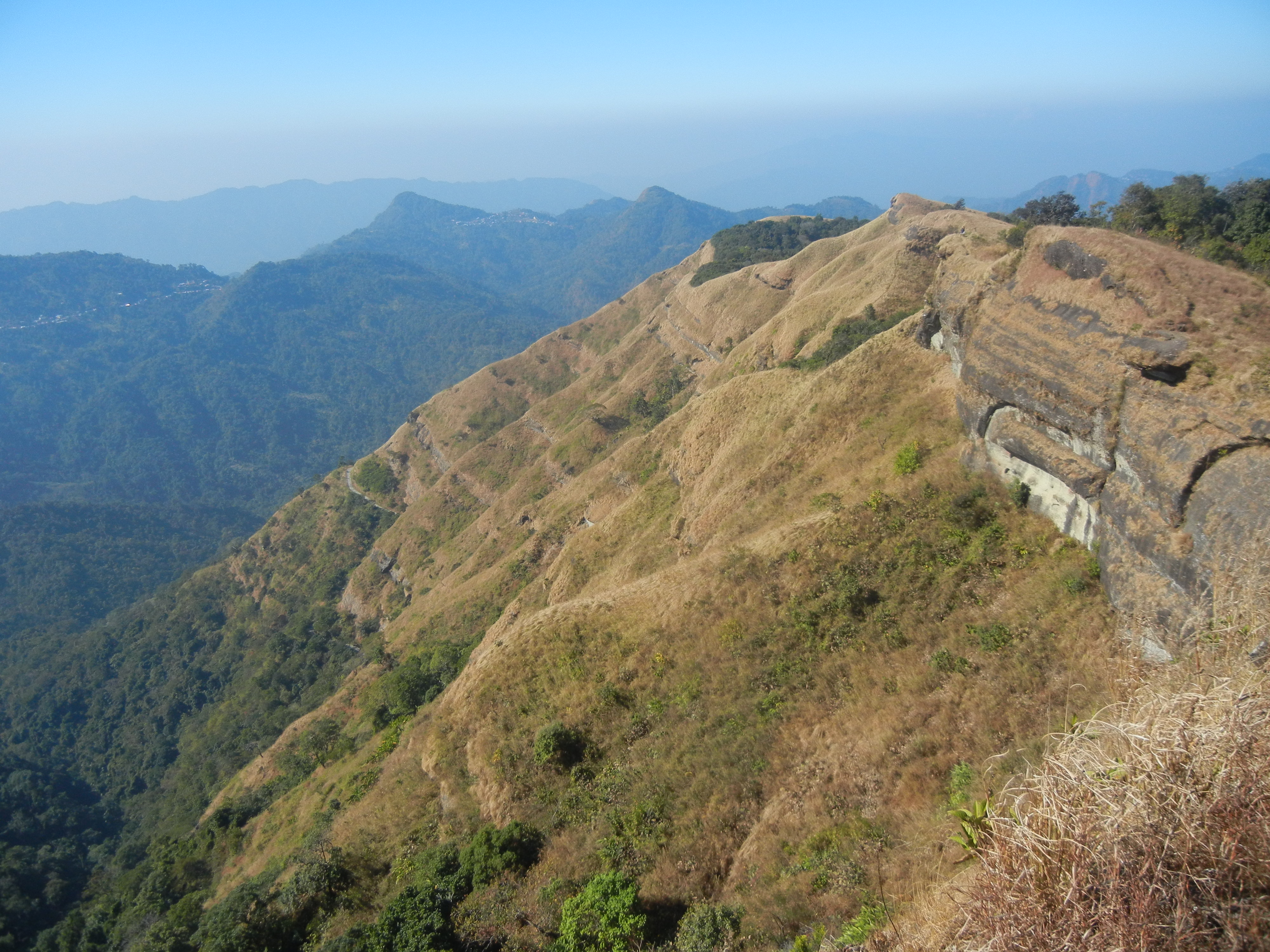
Named after the Khasi tribe, the Khasi Hills are a low mountain formation on the Shillong Plateau part of the Garo-Khasi range and connect with the Purvanchal Range and larger Patkai Range, a series of hills found across the Indo-Myanmar border. The Khasi Hills is and further east. Khasi Hills, and the whole Garo-Khasi-Jaintia range, are in the Meghalaya subtropical forests ecoregion.

With deep lush valleys and conical peaks, these hills are famous for housing the Sohra or Cherrapunjee scarp, one of the regions with the highest annual rainfall in the world. The Nongkhum island, the second largest river island in Asia, is also located within this area. The dense forests mingling with tributaries that eventually drain out into the Brahmaputra, combined with the rich biodiversity of the region have earned the Khasi Hills the title of Scotland of the East.

The Khasi Hills are a great convergence of lush forests, endless verdant grasslands, majestic hills surrounded by playful clouds, waterfalls, and rivers flowing through the creeks, and ancient monoliths filled with mystical caves. Complemented by the abundance of diverse wildlife seen throughout the area, the Khasi Hills region is world-famous for being a prime ecological hotspot.

The region is inhabited mainly by tribal Khasi dwellers, which are traditionally in various chieftainships, states known as the Khasi Hill States. One of its capitals, Sohra, is considered one of the wettest places in the world. The majority of Khasis are Presbyterians followed by Catholics and Anglicans. The highest peak is Lum Shyllong which is 1,968 meters or 6,457 ft high.

The best time to visit the Khasi Hills is from October until April. During this period one will be able to enjoy the natural beauty of the land with waterfalls brimming with life due to the recent monsoon rains, and the flora & fauna will be soothing to the soul. The winters can be chilly, so adequate coverage is required. Avoid going during monsoons, as they are marked by heavy showers, which may prove to be inconvenient.

Places to Visit in East Khasi Hills include Asia’s cleanest village, Mawlynnong as well as Smit which can be reached through the winding roads offering an elegant view of the mountains. The village of Laitkynsew is famous for the 53 feet-long living root bridge which is over a hundred years old known as the Jingkieng Deingjri. The Khasi Hills are an adventurer’s fantasy come to life, with countless caves, peaks, and viewpoints spread across its entirety. Private treks are organised all across the Khasi hill range which is rich with the thriving greenery infused within the hills and accessorised by lakes and waterfalls.

With Meghalaya housing one of the largest cave networks in the world, the labyrinth of rock formations is a sight to behold, with years of mineral deposits from the tributaries of the Brahmaputra creating incredible stalagmites. The excess of impressive structures like monoliths and mighty hills offers tourists a chance to engage in the sport of rock-climbing with the giant monolith Kyllang Rock a favourite amongst rock-climbers and trekkers. The abundance of lakes offer tourists the rare opportunities to enjoy a nice relaxing picnic as well as boating services to immerse oneself in the tranquillity of the area. With its amazing ecological diversity, the region is home to numerous natural parks, where one can marvel at the lush greenery which has been so beautifully maintained by the locals.

Jaintia Hills

Located further east of the Khasi Hills, the Jaintia Hills used to be a part of the Jaintia Hills District. The district has been bifurcated into two separate districts, namely, East Jaintia Hills and West Jaintia Hills on 31 July 2012. Part of the former Jaintia Kingdom, the Jaintia Hills is a land of majestic hills filled with rich natural vegetation and mineral deposits. It is part of the Patkai hill range that extends across the Indo-Myanmar borders and is a relatively smaller hill district as compared to the Khasi and Garo Hills. The twelve Chiefs of the elaka or the tribal province of the Pnars, a Khasi Sub-tribe are styled Dolloi, and the land is called after them in Khasi: Ka Ri Khadar Dolloi or the Land of 12 Tribal Chiefs. The Jaintia hills comprise of two districts: the East Jaintia Hills and West Jaintia Hills. The only princely ruler of the area was the Raja of the Jaintia Kingdom whose winter capital, Jaintiapur is today in Bangladesh, while his summer residence shifted from Sutnga where the family started as Syiems to Nartiang and also has a palace in the commercial centre Borghat.

The best time to visit the Jaintia Hills is during the summer season, when it is mostly warm, with little or no rainfall. The hills receive heavy rainfall during the monsoons. The Jaintia Hills is home to one of the most beautiful waterfalls of India, the Krang Suri Falls. Set against the backdrop of the rugged rocks with the verdant creepers and trees, the unreal shade of blue taken on by the water inspires the artistic side of anyone who views it. The beautiful village of Nartiang is also situated in these fascinating Jaintia hills where one can find the remnants of the Summer Palace of the Jaintia King. The Nartiang Monoliths, a large collection of mighty stones set since the stone age may also be found here. Jowai, the administrative headquarters, is the most developed town in this region and is the only place connected to other towns outside the hills.  Krem Liat Prah is the longest cave, and Synrang Pamiang is the deepest cave, both which are located in the Jaintia Hills. Thadlaskein Lake is a man-made lake, popular among the locals as a picnic spot. The lake is considered to be holy by the people of Raid Mukhla who worship and offer sacrifices near the lake. A popular place among the locals, Khim Moo Sniang is significant for the pig-shaped rock that lies here and is worshipped by the Jaintia community. It is believed that the stone has the power to protect them. Syndai is famous for many caves and caverns in the limestone-borne area which were used as hiding spots during the war between Jaintia Hills and foreign intruders. Borghat village is situated close to the Bangladesh border and the temple there has a significant history because sacrifices were offered here and the temple was damaged during the 1987 earthquake. The Ruparsor Bathing Ghat was made for the recreational purposes of the Royal family. The ghat is made with granite and the water it gets is from the Ruparsor stream, which flows through a Ridge resembling the curved trunk of an elephant.

Garo Hills

Situated close to the Indo-Bangladesh Border, the Garo hills are part of the Patkai hill range, which extends across the Indo-Myanmar border. The hills get their name from the Garo tribe who inhabit the area. The Garo Hills, spanning 8000 sq meters, offers magnificent viewpoints, densely populated with subtropical forests and rare endemic species of animals and birds. The area has been divided into five districts. The Nokrek peak is the highest peak of this hill range, but the Arabella hills and the Tura peak also offer some breathtaking scenery. The Nokrek Biosphere Reserve, one of the most important national parks of international importance, is located in this nature-rich area. The hills are also decked with splendid waterfalls, enriching the ecological coherence of the place. It is one of the wettest places in the world and part of the Meghalaya subtropical forests ecoregion.

The Garo tribe are a culturally rich ethnic group, attaching tradition and significance to many parts of their natural surrounding. In doing so, they protect and respect their habitat, thereby preserving the immaculate allure of their surroundings. The tree of Boldak Matchu Karam, the rock of Naka Chikong, and the lake of Napak are all examples of these traditions, and the maintenance of the same attracts hordes of tourists all year round. Between September and December, the post-harvest festival of 100 Drums Wangala is celebrated with great pomp at the Asnang village, now becoming a multicultural attraction with neighbouring tribes participating in the festivities with great enthusiasm as well. The largest town in the hills is Tura, which is also the most developed area and home to all the important administrative buildings.

The society is matrilineal like the Khasis and the Jaintias. From birth to death, an individual belongs to the mother’s family, irrespective of sex, even after marriage. Marriage within the clan is completely prohibited and severely punishable for both the Khasis and the Garos. The institution of bachelors dormitories which are gradually disappearing is found in the Garo villages. In such dormitories, young people stay and live together till they are married. They receive various training like making various A’chik music instruments, wrestling or traditional sports, and the making of traditional bamboo baskets. This institution is similar to the ancient agoges of Sparta. Today the Khasis and Garos are mostly Christians but were nature worshipers previously.

The Garo Hills is known for its abundance of wildlife and attracts naturalists and photographers. Two mountain ranges, the Arabella range, and the Tura range pass through the Garo Hills, forming the great Balpakram valley in between. The headquarters town of Tura at an altitude of 657 m. The highest point in the Garo Hills is Nokrek Peak at an elevation of 1412 m.

The Garo Hills is a hub of ecological biodiversity. The Nokrek Biosphere Reserve was added to UNESCO’s official list of biosphere reserves in 2009 and is the home of the plant Citrus Indica, first discovered by researchers in this region. The Balphakram National Park is famous for its canopy-covered gorge and unique physical and biological formations and is an ecological hotspot. The Siju Caves is the third longest cave system in India, made of limestone deposits over centuries, by the Simsang river. One can find rare bat species here. A tributary of the Simsang River, the Rongbang Falls is flanked on either side by massive verdant hills of bamboo.

The Garo hills are a hotspot for natural biodiversity, evidenced by the large Nokrek Biosphere reserve and the neighbouring Balphakram National Park. The Selbalgre Hoolock Gibbon Reserve is a great spot to view the rare Hoolock Gibbon. There are several picturesque waterfalls around the hills as well. With limited road connectivity, one must trek through this scenic landscape to reach many villages past the outskirts of Tura. The Tura Peak and Arabella range offer magnificent views from the top, with the Tura peak being relatively easier to scale. Nongkhnum Island located in the West Khasi Hills district is the biggest river island in Meghalaya and the second biggest in Asia. The island is formed by the bifurcation of Kynshi River into the Phanliang River and the Namliang River. Adjacent to the sandy beach the Phanliang River forms a lake. The river then moves along and before reaching a deep gorge, forms a waterfall about 60 meters high called Shadthum Fall. Located near Sohra, the Kshaid Dain Thlen Falls are the falls where the mythical monster of Khasi legend was finally butchered. The axe marks made on the rocks where Thlen was butchered are still intact and visible. On the top of Diengiei, there is a huge hollow, shaped like a cup, believed to be the crater of an extinct pre-historic volcano. A scenic pool with wide, rocky sandbanks located on a stream alongside the Umroi-Bhoilymbong Road is known as Dwarksuid or Devil’s doorway. The highest point of the Garo Hills region of the State, Nokrek Peak stands 1412 m above sea level. The mother germoplasm of Citrus-indica has been discovered by scientific researchers within Nokrek Range which led to the establishment of the National CitrusGene Sanctuary-cum-Biosphere Reserve at Nokrek covering an area of 47 sq km. Imilchang Dare is a waterfall with a deep, wide pool at the bottom making it an exciting swimming pool, full of fish of varied sizes and colours.

After this series, I realise that Meghalaya has so much natural beauty and I am itching to explore this beautiful state soon. The state has so many unexplored places that one may feel like an explorer making a grand discovery. Hopefully, I get to explore this state soon.

Travel Bucket List: India – Meghalaya Part 4

Jowai

The headquarters of the West Jaintia Hills, Jowai is located about 65 km east of Shillong and about 50 km from the Indo-Bangladesh border and is home to the Pnar, a sub-tribe of the Khasi people and a matrilineal society. It is located on a plateau surrounded on three sides by the Myntdu river bordering Bangladesh to the south. Jowai is famous for its bucolic setting and breathtaking views, boasting of lakes, vast open valleys and waterfalls.

Festivals such as Behdeinkhlam, Chad Sukra and Laho Dance attract many tourists each year. Behdeinkhlam, a major festival of the Pnars, is a 4-day event that takes place during July. Behdienkhlam means to drive away evils and plague and is celebrated in all parts of the Jaintia Hills. Dancing takes place in the street to the accompaniment of drums and pipe playing. Although women do not participate in dancing, they have an important role to play at home by offering sacrificial food to the spirits of the ancestors. Each locality prepares a decorative tower-like pillar structure called a rath, carried by 30 to 40 people to a small lake at Aitnar for immersion. The festival culminates when the khnong or the sacred tree is brought to the centre of each locality. In the afternoon, Datlawakor, a form of soccer with a wooden ball, is played between two teams from the upper and lower valleys of the Myntdu River. Those in the team who wins are believed to be blessed with a good harvest. Other festivals include Laho Dance and Chad Sukra.

The Tryshi Falls are often compared to the Elephant falls of Shillong and is located about 8 km from the heart of Jowai. A bridge connects the waterfall’s surroundings with an expanse of green paddy fields. A breathtaking panoramic view of the Pynthor Nein is visible from the bridge. A trek to the bottom of the falls is amazing too. The Krang Suri Falls are located in Amlarem and have chiselled and gravelled footpaths and view points to enable visitors to better appreciate the beauty of the waterfall and its surroundings.

Located at Mukhla, about 20 km from Jowai, the Thadlaskein Lake is a beautiful lake with anthropological importance. A popular tourist spot, the lake is crystal clear and reflects the sky. Unharmed and untouched by man the lake has been turned into a popular picnic spot. A small hotel managed by Meghalaya Tourism is just across the road which offers clean and good service. The lake was constructed by Sajar Nangli, a follower of the former Jaintia King. Surrounded by Pitcher Plants, the Jarain Pitcher Plant Lake, spread over 50,000 sq m, has boat rides which allow one to navigate the plants and is a unique sight. A fountain shaped like a pitcher plant has been installed in the middle of the lake which sits amid gravelled footpaths, arch bridges, a pitcher plant garden and a greenhouse interpretation centre.

Famous for its sacred groves and the beautiful Pynthorwah Valley, the Lalong Park has become popular in recent times. A water eco-park with a view of the Pynthor Wah valley and the Myntdu river is also taking shape to change Lalong into a major tourism hub. 

An ancient and famous temple, the Durga temple which is more than five centuries old is located near the remnants of the Summer Palace. In ancient times, human heads were offered to the goddess at the temple as human sacrifice. During British colonial rule, this practice was abandoned. The oldest church in Jaintia Hills, the Jowai Presbyterian Church was built by the Welsh Presbyterian Mission in the latter part of the 19th century and is one of the few structures in town that retain British architectural influence.

Monoliths exist throughout the length and breadth of the Khasi and Jaintia Hills. However, the largest collection of monoliths are the Nartiang Monoliths. Here also lie the remnants of the Summer Palace with the archway of the site made using red bricks.

The Umlawan Caves are the subcontinent’s deepest and largest caves. These caves are interconnected with the Kot Sati and Umskor Caves and have many stalagmites and stalactites. The caves are 100 m deep and 21km long. Meaning the flower of gold, Syntu Ksair is located on the banks of the Myntdu River and is the centre of the freedom struggle led by Kiang Nanbagh. A memorial has also been set up here in honour of him. Also known as Madan Madiah or Uncle’s Ground, Syntu Ksiar is a valley well irrigated by the Myntdu River. Today, the ground has a monument of U Kiang Nangbah, a fighter of the Khasi people. The Stone Bridge is an old historic stone bridge used by the Jaintia Rajas to cross while travelling from their Summer Capital in Nartiang to their Winter Capital in Jaintiapur, now in Bangladesh. The structure was broken once when an elephant tried crossing it.

Source

Mawlynnong

A small village located close to the India-Bangladesh border in the East Khasi Hills about 75 km south of Shillong, Mawlynnong has been declared Asia’s Cleanest Village in 2003 by Discovery India. Also known as God’s own Garden, Mawlynnong is a community-based eco-tourism initiative where the entire community made collective efforts in making and maintaining the cleanliness of the village. Mawlynnong offers a picturesque natural beauty with lush green valleys, crystal clear water in the river, an abundance of flowering orchids hanging from the trees and extremely clean roads which makes this small village worth visiting. Mawlynnong also offers pleasant weather throughout the year and especially during monsoon.

Mawlynnong also follows the tradition of a matrilineal society and as per the tradition of the Kasi people, property and wealth are passed from the mother to the youngest of her daughters, who also keeps the mother’s surname. Mawlynnong is known for its cleanliness. The waste is collected in the dustbins made of bamboo, directed to a pit and then used as manure. A community initiative mandates that all residents should participate in cleaning up the village. Smoking and use of polythene are banned while rainwater harvesting is encouraged. The reputation as Asia’s cleanest village boosted local tourism and in 2017 it was reported that, according to the village headman, incomes had increased by 60 per cent due to the increase in eco-tourism.

Source

The Dawki River, which is known to be very clean and crystal clear is located about 35 km east of Mawlynnong. Between Mawlynnong and Dawki, one comes across the Bophill Falls. The water falls at a very incredible force to form a river in the Sylhet border area of Bangladesh, making the water appears milky white. Known as the Sky View or Sky Walk, this is a popular attraction at Mawlynnong which is made up of cane and bamboo that offers a complete view of the Indo-Bangladesh border along with the village. To get to this 85 feet tower, one will be charged INR 10 per person. There is another mid-size waterfall within the village which is considered an amazing picnic spot is known as the Mawlynnong Waterfall. The Riwai Village is located 2 km east and is well known for the beautiful trekking it has through rainforests. However, the most popular tourist destination in the village is the small living root bridge made up of the aerial roots of rubber fig trees.

Dawki

96 km southeast of Shillong, Dawki is a border town in the West Jaintia Hills and the gateway to Bangladesh. The town offers scenic views of some of the tallest mountain ranges in Meghalaya and the Bangladesh borderlands. The Dawki Integrated Check Post or the Dawki border crossing on Dawki-Tamabil is one of the few road border crossings between India and Bangladesh. It is used mainly for coal transportation to Bangladesh with some 500 trucks crossing the border every day during peak season.

The Umngot River, also known as the Dawki River and Wah Umngot, is a river which flows through Dawki. The Umngot, a beautiful river with crystal clear waters is arguably one of India’s cleanest rivers and an important fishing spot for local fishermen. The river sits on the India-Bangladesh border, and a white portion of the river, caused by a rise in the current, marks the unofficial boundary between the two countries. A suspension bridge, the Dawki Bridge, hangs over the Umngot River that was constructed in 1932 and is a place of interest. Dawki is popular as a day trip from Shillong with many visitors coming here for the colourful annual boat race during spring on the Umngot River. Boating at the Umngot river is a must at Dawki. The water is so clean and clear that the boats seem to be floating on the river bed, a once-in-a-lifetime experience. The boating charges are around INR 600 for a 40-minute ride. Also known as Dawki Falls, the Umgrem Falls is another waterfall situated very close to the road that marks the border between India and Bangladesh and is highly popular among visitors.

In April 2021, the Meghalaya government decided to construct a dam on the river, because of an electricity shortage. The project was the proposed 210 MW Umngot Hydroelectric Project, which received loads of backlash and opposition from the local villagers, who feared that its construction would disrupt tourism and the project was eventually scrapped.

Balpakram National Park

Located at an altitude of about 910 m or 3,000 ft close to the international border with Bangladesh, the Balpakram National Park was inaugurated in December 1987 and is home to wide species of plants and animals. Located in the southern Garo Hills in Meghalaya, about 167 km from Tura, and about 195 km from Shillong, the park’s vegetation consists of subtropical, grassland, bamboo forest, tropical deciduous trees, and carnivorous plants like the pitcher plant and Drosera. In the southern part of the Garo Hills, species in the national park include the Indian elephant, chital deer, wild water buffalo, red panda, Bengal tiger, and marbled cat. The rivers and lakes in the wildlife reserve are home to various species of birds. A variety of very rare medicinal herbs, which are locally known as dikges, also grow abundantly in Balpakram. The Central government of India has nominated the Garo Hills Conservation Area (GHCA), straddling the South and West Garo Hills, for a World Heritage Site, which includes Balpakram National Park and this has been listed in the UNESCO World Heritage tentative list.

The word Balpakram means the land of perpetual winds, and the national park is blessed with charming grace and breathtaking scenes. The Balpakram National Park is home to many endangered and endemic species of plants and animals. The area is full of sprawling vegetation of deciduous and subtropical trees. The region is also famous for the pitcher plant and other plants of crucial medicinal value that eee commonly found here.

One can find a deep gorge in Balpakram, which is popularly compared to the Grand Canyon of the United States of America. The gorge is referred to as the land of the spirits since it is believed that the spirits of the dead live here temporarily before finally embarking on the journey towards their final abode. Numerous mysterious phenomenon takes place at the Balpakram National Park, for which modern science cannot give any reason, logic, or account. It is widely believed that the ghosts of the dead inhabit the gorge at the national park. There is also a thick schimawallichi tree in the national park, which has a depression on its trunk which seems to be the outcome of the constant tethering of animals and the work of harsh weather. Whenever a tree falls due to the strong winds, another tree situated close by gets affected with the same symptoms. One can also find a massive magnetic rock in the national park. This stone has a hollow space on its surface, which has a powerful magnetic force. Any animal or bird that wanders close to the rock is magnetically drawn towards the hallow, and they are never able to escape from there. Consequently, the animals die. Interestingly, this magnetic force does not affect humans. The steep rock cliffs that can be found in the canyon are supposed to be the natural habitats of the gonchos or evil spirits. These gonchos are believed to carry away people and lead them over steep precipices and inaccessible rock cliffs. They, however, do not cause any harm to their victims.

Source

The Balpakram National Park is also quite famous for its caves, which are complete with beautiful limestone formations of stalagmite and stalactite. The Siju-Dobkhakol Cave is situated on the bank of the Simsang River, just below the village of Siju, around 30 km to the north of Baghmara. This cave is 4772 m long and is renowned for being the third longest cave in India. It contains some of the most beautiful river passages that can be found all across the globe. The Tetengkol-Balwakol Cave, or the Cave of Dwarfs with inverted feet, is situated in Nengkhong village and is the second longest cave in India. Other prominent caves that can be found here include the Dobhakol Chibe Nala and Bok Bak Dobhakol.

The best time to come to Balpakram National Park is from late October to March when the weather is pleasant with little to no rainfall. One can enjoy watching animals during these months when they come to drink water in the rivers and lakes in the national park. There are no entry fees to the park which is open between 7 am to 6 pm daily. Balpakram National Park is a protected place, and prior permission has to be taken from the wildlife authorities before entering the area. One can easily obtain a permit to visit the National park from the DFO office in Baghmara free of cost.

Williamnagar

Formerly known as Simsanggre, Williamnagar is the headquarters of the East Garo Hills and is named after Captain Williamson A. Sangma, the founding Chief Minister of the State of Meghalaya. The township was planned around the erstwhile village of Simsanggre, on the vast plainlands along the banks of the Simsang River, in 1976 after the Garo Hills district of yesteryear was reorganised to carve out a new district called East Garo Hills District.

Where Williamnagar is located has historical importance as it was here that the Garos made their last major resistance to the British intrusion into Garo Hills in 1837. The legendary Garo leader Pa Togan Nengminja Sangma was felled by the British, in a skirmish, at Chisobibra, on the outskirts of Williamnagar, on 12 December 1837. Located about km west of the state capital, Shillong, Williamnagar is a very remote area known for its abundance of natural beauty, being flanked by the mountains and has a rich composition of both water and vegetation.

The Chamera Lake and the Simsang River are must-visit places while at Williamnagar because of their beauty. The conifers carpeting the banks and the clean air make this an unforgettable place. One should make sure they go for a boat ride and soak in the vast expanse of natural beauty. The breathtaking, magnificent and vibrant Domre Falls is a wonderful place to chill and let go of worries. Mrik Wari is close to the Simsang River famous for its rock formations. Some of the formations depict the shape of a baby elephant and its mother. According to legends, the elephants turned into stones after drinking the water from the river at daybreak. There are also several other formations in addition to the scenic view of the river and its beautiful surroundings. 120 km from Williamnagar, is Naka Chikong, a big rock with deep hollows, in the middle of the Ildek river in Badaka village. This big rock is mythologically believed to be swarming with fish, and there is a belief that if anyone inadvertently touches the big rock under whose hole the fish are, all the fish immediately disappear from the river. Home to many rare and protected birds along with other animals, the Siju Sanctuary is also known as Siju Bird Sanctuary. The Simsang Festival is a cultural event held in December which calls upon the best artists of the state with many smaller events taking place.

Baghmara

Located very close to the border with Bangladesh, Baghmara is the headquarters of the South Garo Hills district, about 286 km west of Shillong. The name Baghmara is derived from the fight that took place between Bong Lasker and a wild Bengal tiger where he killed the tiger by crushing its jaws. Therefore the name Baghmara where bagh means a tiger and mara means to kill or die. To honour Bong Lasker, a tomb was built in the heart of the town which was previously known as Barokar, which means 12 streams with baro meaning 12 and kar meaning a stream in Bengali.

Baghmara is not only rich in flora and fauna but also boasts many small lakes, rivers, and rolling hills. Flanked by the South Garo hills and fed by the Simsang river, this town is host to hordes of tourists every year. The Balphakram National Park lies around 66 km away and being a major trade hub with Bangladesh, Baghmara is known for its fish delicacies. The Someshwari River, also known as the Simsang in the Garo language, flows through the town. The famous Siju Cave is about 45 km away and to get to Siju one needs to go through Baghmara. The famous Balphakram National Park is 66 km away and one needs to pass through this town to get there. The town is home to the carnivorous pitcher plant and has the Pitcher plant sanctuary located at Dilsa Hill colony. The town viewpoint is also located on the same spot inside the tourist lodge with a breathtaking view of Baghmara. 4 km from the town of Baghmara lies the Baghmara Reserve Forest, inhabited by elephants, birds, and langurs. There is a provision for elephant rides in the reserve forest. The Baghmara Tyisam Fest is a 3-day fest that kicks off in December with lots of activities from drumming to beach football to fancy dress competitions.

Tura

One of the largest towns in Meghalaya, Tura is located in the foothills of the Tura range of the Garo Hills. Located about 311 west of Shillong, Tura was known as Dura before the Britishers came to the Garo Hills and the name was corrupted to Tura as Tura was easier to pronounce. The climate in Tura is moderate throughout the year and their God Duma is believed to reside in the hills. Filled with small rivulets and green valleys all around, the principal languages spoken in Tura are Garo and English. Tura is relatively deeply rooted in its native Garo roots and boasts of rich undisturbed biodiversity and natural attractions.

The main attraction of the town is the Nokrek National Park which is 12 km from the town where various animals such as the leopard, golden cat, wild buffalo, pheasant, and many more reside. The Nokrek National Park is located close to the National Citrus Gene Sanctuary-cum-Biosphere and this region comprises mainly deciduous and evergreen forests filled with different varieties of trees including the Tura peak which lends its name to the place, insectivorous plants, ferns, rare orchids, and medicinal varieties. In May 2009, Nokrek National Park was added by UNESCO to its list of Biosphere Reserves. The forests also have many fruit trees like plums, peaches, pears, and oranges as well as spices such as ginger, turmeric, and cinnamon. One may also visit the Rongbang Dar Falls, while a trip to this area, without visiting the Siju caves, would remain somewhat incomplete.

Source

Tura Peak, part of a reserve forest is an excellent destination for treks and sightseeing, as it allows panoramic views of the valley from the observatory accompanying it. About 7 km away from Tura, Pelga Falls is famous for angling and is also an excellent picnic spot. It is relatively free from crowds most of the time, making it ideal for those who want some quiet time. The best time to visit the falls is during the monsoon season when the flow is at its peak. Another popular tourist site, situated nearby, is the traditionally constructed Garo Bamboo Bridge, built over the Ganol River. The Rongbang Dar Waterfalls, also known as the Rongbang Dare, are located close to the Chinabat Village, about 39 km west of Tura. At a height of over 120 ft, this waterfall has fantastic visual appeal, especially during the monsoon season when the flow is large and speedy. Located close to the Siju Wildlife Sanctuary, Naphak Lake is a pristine location, excellent for bird watching and fishing. Many of the birds who reside or migrate to the Siju Wildlife Sanctuary can also be spotted here. It is located around 112 km from Tura and can easily be driven to. Tura Peak lies about 872m above sea level and there is a reserve forest at this mountain peak along with a tourist bungalow, a cinchona plantation, and an observatory. The massive yellow plains of Bangladesh welcome you at the peak which is an unforgettable sight. It is also possible to trek to the top of the peak.

The next part, which will be the last part in this series will showcase the various hill ranges that are a part of Meghalaya’s landscape

Travel Bucket List: India – Meghalaya Part 3

Mawphlang

A beautiful village about 25 km southwest of Shillong, Mawphlang is home to Meghalaya’s Sacred Forest. The village lies in the East Khasi Hills and is named Mawphlang as it is one of the several monoliths in the Khasi Hills. The name Mawphlang means Grassy Stone where maw means stone and maw phlang means a grassy stone, and is one of many settlements in the Khasi hills named after monoliths.

Mawphlang was the centre of Presbyterian Church of Wales missionary and medical activity in the Khasi Hills during the 1890s. A dispensary and then a clinic were established in 1878 by Dr Griffith Griffiths who died at Mawphlang in 1892.

Mawphlang is the site of one of the Khasi Hills’ sacred groves. Located on an area of 78 hectares, the sacred forest is of immense spiritual importance to the Khasis and is home to a variety of flora and fauna and is perfect for nature walks or trekking. Locals believe that the sacred forest of Mawphlang is protected by their deity, Labasa. Members of the Lyngdoh clan are ardent followers of the goddess and the protectors of the forest. According to a legend, the forest was first protected by the Blah Clan, who handed it over to the Lyngdohs when they couldn’t defend it anymore. It began with a condition from a Lyngdoh woman who has a son. She stated she would plant five saplings and if the seedling grew and became trees, her son would become a protector of the forest. People believe that nothing can be taken from the forest. Any disrespect towards the sacred forest is believed to upset the deity who then punishes the offenders. People are said to have fallen sick or even died when they disrespected the forest. The sacrifices to please the deity also have a strict procedure. Believers state that if the deity is happy with the sacrifice, she sends a leopard while if she’s not, she sends a snake.

Located opposite the Sacred Forest, the Khasi Heritage Village has been created to showcase the traditional lifestyle of the Khasi tribes that include the Myliem, the Jirang, the Shella, the Wahadarship, the Nongkhhlaw, the Mawphalang and Nongstin, among others. The village has houses built in the conventional Khasi style with bedrooms, kitchens, storehouses etc. It also has a section for archery with the traditional bows and arrows displayed for visitors. There is also an amphitheatre that is often used to screen documentaries and serves as a stage for artists during the Monolith Festival.

Usually held in March, the Monolith Festival is celebrated to re-unite the Khasi Himas through workshops, shows/ performances, art, culture, sports and competitions. The festival is also perfect to get a taste of the traditional Khasi cuisine and spirits. The monolith festival serves as an ideal platform for musicians and singers from Meghalaya. There are also kiosks selling fresh produce at affordable. A museum is also kept to display artefacts, tools, and weapons, traditional daily and occasional items that were extensively used by the Khasis.

Named after David Scott, a British officer, the David Scott Trail is an old trail and one of the most popular trekking routes in Meghalaya. It is a 16 kilometres long trek that stretches from Mawphlang to Lad Mawphlang, both villages known for their history, culture and folklore. A centerstage of Khasi culture, Mawphlang is one of the settlements in the Khasi hills named after monoliths and having sacred groves. The trail was laid down to connect Assam and Bangladesh during the 19th century. The trek can be done from either side, but it is commonly attempted from the Mawphlang side since it makes it a less ascending trail. The trail is not well marked, but is a storehouse of wonderful landscapes that one experiences as one goes through. Rivers, woods, massive rock formations, cascading waters, streams gushing down from mountains, expansive meadows, forest groves and bridges connecting villages, the trek has it all. The 16 km trek is easy to moderate involving ascent and descent with a gradual descent for an hour, a flat walk of 2 to 3 hours and then a gradual ascent for the last 1 hour. The best time to take up this trail is during the winter months, however, it is not recommended during the rainy season because the trail becomes slippery and the river flows at a high force and crossing the river can be difficult then. The trail also gets infested with leeches during the monsoons and so should be avoided then.

Cherrapunji

Located about 54 km southwest of Shillong, Cherrapunji is also known as Sohra which is connected to Shillong by a 50 km scenic road. It is the traditional capital of the Ka Hima Sohra or the Khasi tribal kingdom and the town is known for its double-decker living root bridge. Cherrapunji used to be the wettest place on the planet, but today this distinction has been taken over by Mawsynram which lies close by. However, Cherrapunji still holds the record for the most rainfall in a calendar month and a year. It received 9,300 mm in July 1861 and 26,461 mm between 1 August 1860 and 31 July 1861.  This sub-divisional town is famous for its rich flora and natural attractions. Other natural attractions include cave formations such as the Mawsmai Caves and Krem Phyllut. Asia’s cleanest village, Mawylyngnong is another famous tourist spot here, where visitors can live and experience the food and culture of the village. The misty valleys and the waterfalls in the region make a long drive through Cherrapunji ideal for those who love road trips. The breathtaking panoramic views of the valley and waterfalls such as the Nohkalikai Waterfalls are wonderful experiences to be had.

The original name for Cherrapunji was Sohra which was pronounced Cherra by the British. This name eventually evolved into a temporary name, Cherrapunji, meaning the land of oranges, which was first used by tourists from other parts of India. It has again been renamed to its original Sohra. The history of the Khasi people, the native inhabitants of Cherrapunji may be traced to the early part of the 16th century. Between the 16th and 18th centuries, they were ruled by the tribal Syiems or chiefs of Khyriem’ in the Khasi Hills. The Khasi hills came under British authority in 1883 with the submission of the last of the important Syiem, Tirot Sing Syiem. The superstructure of Khasi society rests in its matrilineal system. Despite abundant rainfall, Sohra faces an acute water shortage and the inhabitants often have to trek very long distances to obtain potable water. Irrigation is hampered due to excessive rain washing away the topsoil as a result of human encroachment into the forests. Recent developments in rain-water harvesting techniques in the area have greatly helped the town and its neighbouring villages.

The Jingkieng Nongriat Double Decker Living Root Bridge is hidden deep in the lush, green forests of Cherrapunjee. Also known as the Umshiang Double Decker Living Root Bridge, this area is famous for root bridges made of Indian rubber trees, but the Double Decker Bridge is the most famous due to its large size. It is 3 km long at a height of 2400 feet with the Umshiang River flowing beneath it. Because it is a double-decker bridge, the bridge has two decks or tiers, created due to the entanglement of the roots. The upper bridge is 20 meters long and is difficult to reach if one is not physically fit enough to climb to the top. These bridges are crafted by hand, as done by the Khasi people for centuries, intertwining and weaving together the aerial roots of banyan trees on opposite sides of a stream-filled gorge. These bridges are made from the Indian rubber tree which has strong roots and only grows in the Northeastern part of India. The roots are trained to be shaped into a bridge by pulling the roots and twisting them or braiding them in the required direction. But, the bridges cannot be used immediately after shaping. The roots require at least 15 years to grow strong enough to withstand the weight of people walking across. The Jingkieng Nongriat Double Decker Bridge is said to be over 200 years old and only 50 people can use the bridge at the same time. The bridge starts at the village of Tyrna and crosses the Umshiang river during its journey. Getting to the actual bridge is a bit of a trek. The hike down to the bridge has about 3500 to 3600 steps each way to the bridge and back from the base village of Tyrna, which is 20 km from the main town of Cherrapunjee. On the way to the bridge, one can find several other smaller bridges, some of which are not naturally held up. At the site of the bridge, there is also a guest house where tourists can stay for a very low price. It is advised to not visit the bridge during the monsoons, between May and September, because the trek is slippery. The trek takes around 4 to 6 hours depending on the trekker’s speed.

Known as the tallest plunge waterfall in the country, the Nohkalikai Falls are the fourth highest waterfall in the world which plunges 340 meters from a verdant cliff. Tucked in between the evergreen rainforest of Khasi Hills the falls plunge into a plunge pool with an unusual shade of green. The falls are fed by the rainwater collected on the summit of a comparatively small plateau and decrease in power during the dry season, from December to February.

According to local legend, in a village called Rangjyrteh, upstream from Nohkalikai Falls, there lived a woman named Likai who found she had no choice but to remarry following the death of her husband because she was left with an infant daughter and scant means of earning a living, so to sustain herself and feed her child she took on the arduous job of a porter. Her work required her to leave the child unattended for long periods and what little time she could spend at home was devoted almost entirely to caring for her baby. Realising that raising a child required both parents, Ka Likai married a second time for the sake of her daughter. However, as the mother to an infant, she was obliged to give her daughter constant attention, at the expense of giving her second husband the love he thought he deserved. Consumed with jealous rage and a hatred for his stepdaughter, he killed the infant in cold blood and cooked her flesh, after first throwing away her severed head and bones to hide all traces of the murder. When Likai returned, she found the house empty, although someone had prepared a meal. She wanted to go and look for her daughter but was so famished from her labours that she fell upon the dish of cooked meat, devouring it until she could eat no more. Ka Likai usually chewed a betel quid after her meal but was horrified to discover a severed finger near the place where she usually prepared her betel nuts and betel leaves. Realising what had happened in her absence she went mad with anger and grief and began to run in a frenzy, all the while swinging a hatchet in her hand. She finally ran right off the edge of the plateau, plunging to her death, unable to bear any longer the thought that she had unknowingly eaten her murdered daughter. The waterfall from which she leapt was named Nohkalikai Falls as a grim reminder of the tragedy that had befallen the unfortunate Ka Likai.

The best time to explore the falls is between October to December and from March to May as these are the clearest months in Cherrapunjee. However, even then, one cannot guarantee a good sight of the falls due to imminent cloud cover. In winters the lagoon below the falls is largely dried up, while it brims with water in the summers. Angling, trekking, landscape photography, bird watching and swimming are some of the activities that can be enjoyed at the falls. The falls are open from 8 am to 5 pm and have an entry fee of INR 10 per person.

The Wakaba Falls are another scenic falls located in the area as are the Dainthlen Waterfalls which is one of the popular falls in Cherrapunji. Legend has it that in the caves near the falls an evil snake was once killed with the snake representing greed and evil. There are carving on the rocks and caves nearby. The Dainthlen Falls are about 5 km from Cherrapunji. The Mawkdok Dympep Valley View is a viewpoint developed by the state government that lies at the beginning of the Sohra tourism circuit.

Meghalaya is home to some amazing and mysterious cave systems and the Mawsmai Cave is by far the most popular of the lot. Located just 6 km away from the heart of Cherrapunji, the Mawsmai Cave is a breathtaking maze of caves in the East Khasi Hills. The well-lit caves are a view to behold when the glistening light meets with the limestone to create countless hues and patterns of light. There is plenty of flora and fauna within the cave which is 150 m in length and is not as long compared to the other caves in the region but it provides one a glimpse of life underground. One should carry a torch in case they wish to explore the darker corners of the cave system at Mawsmai. The cave is open between 9:30 am to 5:30 pm and has an entry fee of INR 10 per person with a camera fee of INR 15 per person.

Located south of Cherrapunji, the Krem Phyllut is a major tourist attraction owing to the caves. There are three different entrances to the caves and two separate river passages within and it is always crowded with locals and tourists.

The Eco Park is another local favourite because the Shillong Agri-Horticulture has given this park many beautiful orchids that are housed in the Eco Park’s greenhouse. The Eco park’s biggest USP is the viewpoint from where one can enjoy views of the massive, yet exotic Sylhet Plains of Bangladesh.

The Khasi Monoliths are located close to the Mawsmai Falls. These are amazing underground mazes and passages of age-old caves and are stones standing as memoirs of various ancestors.

Nongpoh

Nongpoh is the administrative centre of the Ri-Bhoi district and is located about 52 km north of the state capital of Shillong and about halfway between Shillong and Guwahati. A small town north of the East Khasi Hills, Nongpoh is situated very close to the gorgeous Brahmaputra plains and is used as a stopover between Shillong and Guwahati. The town is filled with beautiful rivers, plush green trees and serene climatic conditions. The Lum Nehru Park is a one-hour drive from Nongpoh and is a lush garden. Full of scenic beauty with lush green lawns and gardens, aviaries and wonderful orchids, this garden is a local favourite and when one visits the park, one can see why. Mythologically significant, the Lum Sohpetbneng is located about 40 km from Nongpoh. Popularly known as the Navel of Heaven, it is a pilgrimage site for the local Khasi population. At a height of 1343 metres, the Lum Sohpetbneng is enveloped in verdant greenery and surrounded by majestic peaks creating a viewpoint for the visiting tourists, serving as a perfect place for nature photography. The peak of Sohpetbneng symbolises the deep-rooted spiritual belief of the Hynniewtrep or the Seven Huts people predominating the West Khasi Hills, East Khasi Hills, Ri-Bhoi and Jaintia Hills.  It is believed that it was on this spot that a golden ladder connected Heaven and Earth, creating a direct connection between man and God. The connection was later severed according to a divine decree and every year in February, the Khasi people gather at Lum Sohpetbneng to conduct their rites and rituals. The beautiful Church of Christ is just at a stone’s throw away from the famous Lemawlong Market.

Mawsynram

Reportedly the wettest place on Earth, Mawsynram is a town in the East Khasi Hills, about 61 km southwest of Shillong. With an average annual rainfall of 11,872 mm or 467.4 inches, Mawsynram received 26,000 millimetres (1,000 in) of rainfall in 1985 according to the Guinness Book of World Records. On June 17th 2022, Mawsynram set a new record by receiving 1003.6 mm in 24 hours which has now become its highest single-day record for June and for its all-time single-day record beating its former record of 944.7 mm on June 7th 1966.

The Maw in Mawsynram is a Khasi word meaning stone and symbolises the unique megaliths unearthed in the Khasi Hill area. The village is well known for its huge formation of a stalagmite, which takes the shape of a Shivaling. The rains are so powerful in Mawsynram that the locals make use of thick grass to soundproof their homes from the thunderous rain. About 25 km away from Mawsynram, Mawlyngbna is known for rich fossils and a natural geyser.

The Mawjymbuin Cave is located in Mawjymbuin village and is a religiously significant site. Made of calcareous sandstones and having numerous stalagmites which are formed as a result of calcium carbonate depositions, weathering and the dripping of mineral-enriched liquids, the 209-metre-high cave is of special interest to geologists who conduct special research here. Inside this cave is a pair of notable speleothems that are stalactites shaped like a cow’s udder over a large stalagmite. The Mawjymbuin Cave is also thronged by naturalists, photographers, pilgrims and tourists alike. A rock-shaped structure arising from the earth, shaped like a shiva linga is the primary attraction of the cave and is highly revered by Hindus. It also has a thin stream flowing towards the eastern end of the cave. There are many rift entrances and passages to the cave, some of which are tough to enter through. The Mawsmai caves are an ideal location for cave exploration and cave diving.

The Nohsngithiang Falls is also known as the Mawsmai Falls because it is situated in the Mawsmai Village. One of India’s tallest waterfalls and a major tourist attraction, the Nohsngithiang Falls falls from a height of about 1033 feet, segmented into seven different sections, giving it the epithet of Seven Sister Waterfalls. The waterfall is seasonal and plunges over limestone-covered hills only during the rainy season. The falls are symbolic of the seven sister states of Northeast India namely Assam, Arunachal Pradesh, Manipur, Nagaland, Tripura, Mizoram and Meghalaya. The mesmerising waterfall cannot be entered into but creates a spectacular viewpoint to view the surrounding beauty of Mawsmai. The beauty of Nohsngithiang Falls is indescribable during sunset when the rays of the sun fall on it creating a perennial rainbow, which is also one of the major highlights of the place. The falls are open between 9 am to 5 pm daily.

The next part will continue to showcase some well known and little known places in Meghalaya.