In My Hands Today…

Travels with Charley: In Search of America – John Steinbeck

A quest across America, from the northernmost tip of Maine to California’s Monterey Peninsula

To hear the speech of the real America, to smell the grass and the trees, to see the colors and the light—these were John Steinbeck’s goals as he set out, at the age of fifty-eight, to rediscover the country he had been writing about for so many years.

With Charley, his French poodle, Steinbeck drives the interstates and the country roads, dines with truckers, encounters bears at Yellowstone and old friends in San Francisco. Along the way he reflects on the American character, racial hostility, the particular form of American loneliness he finds almost everywhere, and the unexpected kindness of strangers.

Travel Bucket List: India – Arunachal Pradesh Part 2

Bomdila

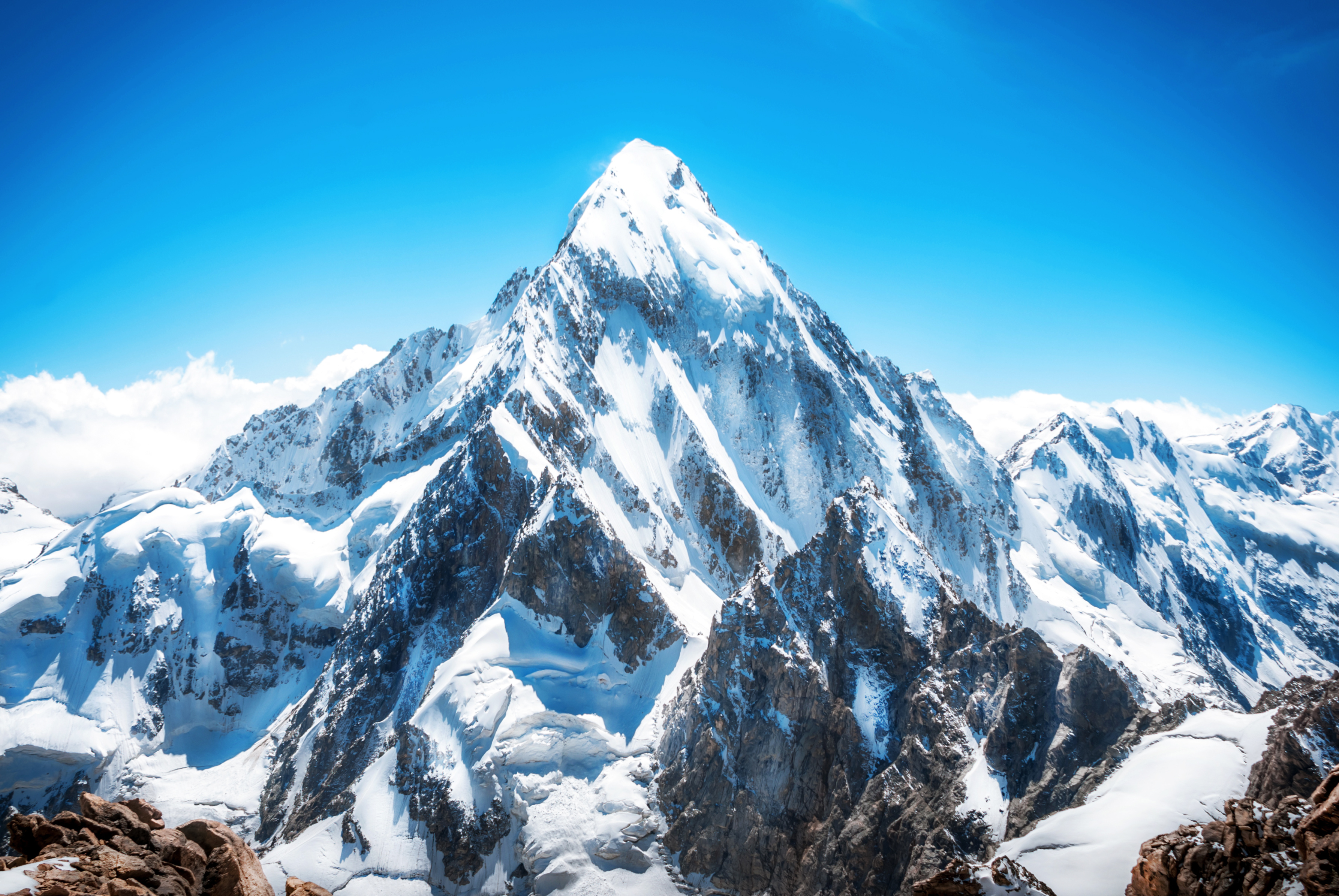
270 km west of Itanagar, Bomdila is a lesser-known destination set in the eastern Himalayas with beautiful views amidst nature. It is also well known for its apple orchards and many Buddhist monasteries. Bomdila was ruled by tribal rulers until the arrival of the British who made it part of Arunachal Pradesh in 1873. The Bomdila Monastery also known as Gontse Gaden Rabgyel Lling monastery and the Eaglenest Wildlife Sanctuaries are the major attractions. Tourism is on the rise here and Bomdila has become a halt station for tourists travelling to Tawang. The Bomdila pass offers views of Kangto and Gorichen Peaks, the highest in the state.

Also known as Gentse Gaden Rabgyel Lling monastery, the Bombdila monastery was built in 1965 by the twelfth incarnation of the TsonaGontse Rinpoche. And was rebuilt by the thirteenth reincarnation, TsonaGontseRinponche who renovated the monastery by building a larger prayer hall. Inside the Gompa, there’s a huge prayer, which is used by the lamas for praying; the temple of Buddha, and a tiny quarter of monks. Apart from its religious significance, the monastery is also known for its natural beauty with stunning vistas that are fabulous and breathtaking. The Upper Gompa is located atop a steep hill. There is a monk school, a prayer hall as well as a temple dedicated to Lord Buddha on the premises. The Lower Gompa is located at the end of Bazaar Street and the main attraction is the marvellous Tibetan architecture and massive prayer hall inside. There is also a craft centre located opposite it which should be visited. R.R Hill is the highest point of Bomdila and from this height, visitors can see the roads leading to the Bhutan border as well as the one up Tawang.

The Eagle’s Nest Wildlife Sanctuary lies between the Sessa Orchid Sanctuary and the Pakhui Tiger Reserve. It’s a great place for bird watching with over 450 species spotted here. The sanctuary conjoins the Sessa Orchid Sanctuary to the northeast and the Pakhui Tiger Reserve across the Kameng river to the east. Altitude ranges here are extreme, from 500 m to 3,250 m and are part of the Kameng Elephant Reserve. The sanctuary derives its name from the Red Eagle Division of the Indian army which was posted in the area in the 1950s. Eaglenest is bounded to the north by the Eaglenest Ridge and the reserved forests of the Bugun community and adjoins the Tawang district to the north. There are no distinct geographical features delineating its western boundary along the Bhutan border and the southern boundary. Eaglenest has an unpaved road running from its base to Eaglenest pass at 2,800 m allowing good access to the entire altitudinal range, making it accessible to the military, scientists and ecotourists.

Eaglenest Wildlife Sanctuary is well known as a major birding area and is home to at least 454 species of birds. The sanctuary has the distinction of having three tragopan species, perhaps unique in India and is where the Bugun liocichla was first discovered in 1995 and again observed and described in 2006. The sanctuary is also home to a wide variety of herpetofauna including at least 34 species of amphibians, 24 species of snakes and 7 species of lizards as well as at least 165 species of butterflies. This area is extremely important for the continued well-being of the Asian elephant. Elephants regularly move up from the Assam plains to the Eaglenest ridge at 3250 m in summer, perhaps the highest altitude that elephants reach in India.

Tawang

The town of Tawang or Dawang is located about 450 km northwest of Itanagar at an elevation of approximately 3,048 m to the north of the Tawang Chu river valley, roughly 16 km south of the Line of Actual Control with China. In 1989, the present-day Tawang district to the north of the Sela Pass was split off as a separate district. Tawang is inhabited by the Monpa people.

Historically, Tawang was under the control of Tibet. During the 1914 Simla Conference, Tibet and British India signed an agreement delineating their common boundary in the Assam Himalaya region, which came to be known as the McMahon Line. By this agreement, Tibet relinquished several hundred square miles of its territory, including Tawang, to the British. This agreement was not recognised by China and records show that the Tibetans regarded the border agreed upon in 1914 as being conditional upon China accepting the Simla Convention. Since the British were unable to get China’s acceptance, the Tibetans regarded the MacMahon line as invalid. The British did not implement the McMahon Line for over two decades, during which Tawang continued to be administered by Tibet. In November 1935, the British government demanded that Tibet implement the border agreement which was met with resistance from the Tibetan government implying that China’s acceptance of the Simla Convention was a prerequisite to all such concerns. Tibet refused to surrender Tawang, partly because of the importance attached to the Tawang Monastery. In 1938 the British tried to assert sovereignty over Tawang by sending a small military column which was met with strong resistance from the Tibetan government and a serious protest was lodged against the British Indian government.

After the Sino-Japanese war in 1941, the Assam government tightened its hold on the area of the Nort-East Frontier Agency, NEFA which later became Arunachal Pradesh. In 1944 administrative control was extended over the area of the Tawang tract lying South of the Sela Pass Though the Tibetan tax-collectors packing and protests were brushed aside, no steps were taken to evict Tibet from the area north of the pass which contained Tawang town. This situation continued after India’s independence but underwent a decisive change in 1950 when Tibet lost its autonomy and was incorporated into the newly established People’s Republic of China. In February 1951, India sent an official with a small escort and several hundred porters to Tawang and took control of the remainder of the Tawang tract from the Tibetans, removing the Tibetan administration. During the Sino-Indian war of 1962, Tawang fell briefly under Chinese control, but China voluntarily withdrew its troops at the end of the war and Tawang returned to Indian administration. But China has not relinquished its claims on most of Arunachal Pradesh including Tawang.

The Tawang Monastery was founded by the Merak Lama Lodre Gyatso in 1681 following the wishes of the 5th Dalai Lama, Ngawang Lobsang Gyatso. To fix the perimeter of the Dzong, the Dalai Lama had also given a ball of yarn, the length of which was to form the limit of the monastery. Perched at the height of 3,000 metres above sea level, the monastery belongs to the Gelugpa sect and is the largest Buddhist monastery in India and the biggest Buddhist monastery in the world outside of Lhasa, Tibet. It is a major holy site for Tibetan Buddhists as it was the birthplace of the sixth Dalai Lama, Tsangyang Gyatso. The monastery is believed to be 400 years old and has control over 17 gompas in the region.

Offering breathtaking views of the Tawang-Chu Valley, the monastery is built as a large three-storeyed mansion enclosed by a 925 feet long compound wall and is home to over 300 monks. The most prominent attraction in the monastery is the massive statue of Lord Buddha which is 8 m in height. The main temple, Dukhang, boasts magnificent interiors with beautiful artwork while the inner walls contain sketches and paintings of Bodhisattvas. The library is stocked with valuable old scriptures like Kangyur and Tengyur and all primary structures are built in the traditional style of Buddhist architecture. The Tawang Manuscript Conservation Centre was established in the monastery in August 2006, which has curated 200 manuscripts, and 31 manuscripts have been treated for preservation.

The full name of the monastery is Tawang Galdan Namgye Lhatse where Ta means horse and wang means chosen, which together form the word Tawang, meaning the location selected by a horse. Gadan means paradise, Namgyal means a complete victory and Lhatse means divine. Thus, the full meaning of the Tawang Galdan Namgye Lhatse is the site chosen by the horse is the divine paradise of complete victory.

There are three legends which speak of the establishment of the monastery. In the first legend, it is said that the location of the present Monastery was selected by a horse which belonged to Merag Lama Lodre Gyatso who was on a mission assigned by the 5th Dalai Lama to establish a monastery. After an intense search, when he failed to locate a suitable place, he retired to a cave to offer prayers seeking divine intervention to choose the site. When he came out of the cave, he found his horse missing. He then went in search of the horse and finally found it grazing at the top of a mountain called Tana Mandekhang, which in the past was the palace of King Kala Wangpo. He took this as a divine and auspicious guidance and decided to establish the monastery at that location. Seeking the help of the local people, Mera Lama established the monastery at that location in the latter part of 1681. The second legend of the derivation of the name Tawang is linked to Terton Pemalingpa, the diviner of treasures. Here, he is stated to have given initiations of Tamdin and Kagyad, which resulted in the name Tawang where Ta is an abbreviated form for Tamdin and Wang means initiation. According to the third legend, a white horse of the Prince of Lhasa had wandered into Monpa region. People, who went in search of the horse, found the horse grazing at the present location of the monastery. The people of the area then worshipped the horse and the location where it was found and venerated it every year. Eventually, to honour the sacred site, the Tawang Monastery was built at the site. There is one more legend narrated about the Goddess painted on a thangka in the monastery which is that of Palden Lhamo. This female deity is compared to the Hindu Goddess Kali. Like Goddess Kali, Palden Lhamo’s thangka is drawn in black colour, with flaming eyes, dressed in a skirt made of tiger skin, and a garland of skulls around her neck. A moon disc adorns her hair, similar to the one seen on Shiva. She is also associated with Goddess Saraswati and Ma Tara. Legend also states that in the past she had lived in Sri Lanka as the consort of a demon king who practised human sacrifice. As she was not supportive of this practice she fled from the kingdom. As she was running away, the king shot her with an arrow, which struck the backside of the mule that she was riding. When she drew out the arrow, it left a gaping hole in the mule’s back, and through this gap, Palden Lhamo could watch the teachings of Lord Buddha.

At the entrance to the monastery, there is a colourful gate structure, known as the Kakaling, built in the shape of a hut-like structure, with the roof featuring mandalas. A distinctive mural is of Ningmecahn, the protector deity of the Bon religion, who is considered the guardian deity of the Tawang region. A notable feature on the wall of the front porch on the ground floor is a footprint on a stone slab said to have belonged to a resident, a water carrier, known as Chitenpa who served in the monastery for a long time and on one day announced that he had completed his service to the monastery and then stamped his left foot on the stone slab which created a dented formation of his step. This step is venerated as a miracle.

Torgya, also known as Tawang-Torgya, is an annual festival held in the monastery whose objective is to seek protection from evil spirits and pray for the prosperity and happiness of the people in the coming year. The famous dance, Losjer Chungiye is performed by the monks at the festival. The monastery is open daily between 7 am and 7 pm.

Arunachal Pradesh’s lifeline, Sela Pass connects Tawang to the rest of the country. Not just important geographically, Sela Pass is breathtakingly beautiful always covered in snow providing gorgeous views of the eastern Himalayan range. The rocky pass is also home to one of the state’s most beautiful lakes, the Sela Lake. One needs an inner line permit to visit Sela Pass. Located at an altitude of 4170 m, Sela Pass and Sela Lake lie on on your way to Tawang which is about 80 km from the pass. Also known as Se La where La means a pass, the pass is usually covered in snow and supports scarce amounts of vegetation. Sela Lake, near the summit of the pass, is one of approximately 101 lakes in the area that are sacred in Tibetan Buddhism. Sela Lake is a large lake located on the north side of the pass at an elevation of 4,160 m and often freezes during winter and is drained in the Nuranang River, a tributary of the Tawang River. Limited vegetation grows around the lake which is used as a grazing site for yaks during the summer. Construction of the Sela Tunnel which is underway will bring Tawang on the railway map through the Bhalukpong–Tawang railway line.

According to legend, a sepoy of the Indian Army named Jaswant Singh Rawat fought alone against the Chinese soldiers near the pass during the 1962 Sino-Indian War. A tribal woman named Sela who had brought food and water to him is said to have killed herself upon seeing the dead body of Jaswant Singh Rawat. Singh was posthumously awarded the Maha Vir Chakra for his courage and devotion to duty. Even though the pass is open throughout the year, the best months to visit are October, November, March, April and May as there are fewer chances of the route being snowed in.

One of India’s remotest lakes, Madhuri Lake or Sangetsar Lake is a gorgeous lake against the Himalayas. The lake was made popular due to its appearance in a Bollywood movie and is known after its lead actress Madhuri Dixit who danced on its shores. The lake was previously known as Shonga-tser Lake and is located on the way from Tawang to Bum La Pass at an altitude of 12,000 ft above sea level just 30 km northeast of Tawang. The lake was created by falling rocks, boulders and trees in an earthquake and is tucked between huge mountains with many upright tree trunks standing in its belly as if guarding the lake and is special to Buddhists of India and Tibet who come here every year to pray. The best months to visit the lake are during October, November, March, April and May as the cold at this time subsides a little to allow normal tourist activities. Visits by civilians are only possible with permission from the Indian Army. The track is very treacherous, only SUVs advisable, and that too only on clear days with no snowfall or rainfall. Located almost 25 km from Tawang, the immensely picturesque P.T. Tso Lake is a perfect picnic spot, depending on the weather.

Largely known, the Nuranang Falls lie deep in the forest of Tawang and is one of the most spectacular waterfalls in the country. A beautiful white sheet of water that descends from the height of about 100 meters, it is a part of the Nuranang River which originates at the Sela Pass and just after the falls, merges with the Tawang River. Popularly known as the BTK waterfall, the Bap Ten Kang has crystal clear waters inside a lush green forest. The scenery around the falls is dotted by high hills all around, covered in thick greenery and mist hanging about. At the falls, one can visit the Hydel plant.

Gorichen Peak is Arunachal Pradesh highest peak and is located between Tawang and West Kameng at an altitude of 22,500 f above sea level, roughly about 164 km from Tawang. The peak is locally known as Sa-Nga Phu, which means the Kingdom of the Deity and is considered to be one of the sacred peaks protecting the people from the evils according to the local Monpa tribe.

The Tawang War Memorial is a 40 feet colourful structure dedicated to the martyrs of the Sino-India War of 1962 overlooking the scenic Tawang-Chu valley.

In My Hands Today…

Koh-I-Noor: The History of the World’s Most Infamous Diamond – William Dalrymple and Anita Anand

On 29 March 1849, the ten-year-old Maharajah of the Punjab was ushered into the magnificent Mirrored Hall at the centre of the great Fort in Lahore. There, in a public ceremony, the frightened but dignified child handed over to the British East India Company in a formal Act of Submission to Queen Victoria not only swathes of the richest land in India, but also arguably the single most valuable object in the subcontinent: the celebrated Koh-i Noor diamond. The Mountain of Light.

The history of the Koh-i-Noor that was then commissioned by the British may have been one woven together from gossip of Delhi Bazaars, but it was to be become the accepted version. Only now is it finally challenged, freeing the diamond from the fog of mythology which has clung to it for so long. The resulting history is one of greed, murder, torture, colonialism and appropriation through an impressive slice of south and central Asian history. It ends with the jewel in its current controversial setting: in the crown of Queen Elizabeth the Queen Mother.

Travel Bucket List: India – Arunachal Pradesh Part 1

Also known as the Land of the Dawn-lit Mountains in Sanskrit, Arunachal Pradesh in northeast India was formed from the erstwhile North-East Frontier Agency (NEFA) region and became a state on 20 February 1987. It borders the states of Assam and Nagaland to the south and shares international borders with Bhutan in the west, Myanmar in the east, and a disputed border with China in the north at the McMahon Line. Arunachal Pradesh is the largest of the Seven Sister States of Northeast India by area and shares a 1,129 km border with China’s Tibet Autonomous Region. Itanagar is the state’s capital and its largest city. The area around the border is heavily fortified. Under the Foreigners (Protected Areas) Order of 1958, Inner Line Permits (ILPs) are required to enter Arunachal Pradesh through any of its check posts on the state’s border with Assam.

An ethnically diverse state, the Monpa people are predominant in the west, the Tani people in the centre, the Mishmi and Tai people in the east, and the Naga people in the southeast of the state. About 26 major tribes and 100 sub-tribes live in the state with the main tribes being the Adi, the Nyshi, the Singpho, the Galo, the Tagin, and the Apatani.

A major part of the state is claimed by the People’s Republic of China as part of the region of South Tibet. During the 1962 Sino-Indian War, most of Arunachal Pradesh was captured and temporarily controlled by the Chinese People’s Liberation Army.

In the ancient and medieval periods, Northwestern parts of this area came under the control of the Monpa kingdom of Monyul, which flourished between 500 BC and 600 CE. The Monpa and Sherdukpen keep historical records of the existence of local chiefdoms in the northwest as well and the remaining parts of the state, especially the foothills and the plains, were under the control of the Chutia kings of Assam. Recent excavations of ruins of Hindu temples indicate they were built during the Chutia reign. The 400-year-old Tawang Monastery in the extreme north-west of the state provides historical evidence of the Buddhist tribal people with the sixth Dalai Lama, Tsangyang Gyatso born in Tawang.

In 1912–13, the North-East Frontier Tracts were established by the British colonial rule with agreement from the indigenous peoples and the area was divided into three sections, which eventually came to be called the Ballipara Frontier Tract, the Lakhimpur Frontier Tract and the Sadiya Frontier Tract. Around 1913–1914, representatives of the de facto independent state of Tibet and Great Britain met in India to define the borders of Outer Tibet, concerning China. The British administrator Sir Henry McMahon drew the 890 km McMahon Line as the border between British India and Tibet, placing Tawang and other areas within British India. The representatives devised the Simla Accord including the McMahon Line, but the Chinese representatives did not concur. The Chinese position was that Tibet was not independent of China and could not sign treaties, so the Accord was invalid, like the Anglo-Chinese Convention of 1906 and the Anglo-Russian Convention of 1907. British records show that the condition for the Tibetan government to accept the new border was that China must accept the Simla Convention. As Britain was not able to get acceptance from China, Tibetans considered the MacMahon line invalid.

During the time that China did not exercise power in Tibet, the line had no serious challenges, but in 1935, it was discovered that the McMahon Line was not drawn on official maps. The Survey of India published a map showing the McMahon Line as the official boundary in 1937 and in 1938, two decades after the Simla Conference, the British finally published the Simla Accord as a bilateral accord and the Survey of India published a detailed map showing the McMahon Line as a border of India. In 1944, Britain established administrations in the area, from Dirang Dzong in the west to Walong in the east. After India’s independence in 1947 and the establishment of the People’s Republic of China in 1949, the new Chinese government still considered the McMahon Line invalid.  In November 1950, the PRC was poised to take over Tibet by force, and India supported Tibet.

What is now Arunachal Pradesh was established as the North-East Frontier Agency (NEFA) in 1954 and Sino-Indian relations were cordial until 1960. The resurgence of the border disagreement was a factor leading to the Sino-Indian War in 1962, during which China captured most of Arunachal Pradesh. However, China soon declared victory, withdrew back to the McMahon Line and returned Indian prisoners of war in 1963. The war resulted in the termination of barter trade with Tibet.

The North-East Frontier Agency was renamed Arunachal Pradesh on 20 January 1972, and it became a union territory. The state of Arunachal Pradesh came into being on 20 February 1987. In 2003, the Dalai Lama said that Arunachal was part of Tibet and in January 2007, he said that both Britain and Tibet had recognised the McMahon Line in 1914. In 2008, underscored that Arunachal Pradesh was a part of India under the agreement signed by Tibetan and British representatives. In recent years, China has occasionally asserted its claims on Tawang with India rebutting these claims and informing the Chinese government that Tawang is an integral part of India.

The state is primarily a hilly tract area nestled in the foothills of the Himalayas with almost 95% of the land under forest cover. Arunachal Pradesh has among the highest diversity of mammals and birds in India with around 750 species of birds and more than 200 species of mammals in the state. Arunachal’s forests account for one-third of the habitat area within the Himalayan biodiversity hot-spot. There are two tiger reserves in the state: a reserve in Namdapha National Park and Pakke Tiger Reserve.

The state is mentioned in the literature of the Kalika Purana and the Mahabharata. It is supposed to be the Prabhu Mountains of the Puranas and it was here that the sage Parashuram washed away his sins, sage Vyasa meditated, King Bhishmaka founded his kingdom and Lord Krishna married his consort Rukmini. The widely scattered archaeological remains at different places in Arunachal bear testimony to its rich cultural heritage. The climate varies from hot and humid to heavy rainfall in the Shivalik range. It becomes progressively cold as one moves northwards to higher altitudes.

Itanagar

Arunachal Pradesh’s capital and largest city, Itanagar is the seat of the state’s seat of government, as well as the seat of the Guwahati High Court’s permanent bench at Naharlagun. The city is inhabited by several tribes like the Nyishi, the Adi, the Apatani, the Tagin, the Galo and the Nyishis who are the original inhabitants.

One of the most historical sites in Arunachal Pradesh, Itanagar is named after Ita Fort which means a fort made of bricks where Ita is Ahom for bricks. Built around the 14th or 15th centuries, the fort has an irregular shape, built with bricks identified by scholars as built during the rule of the Chutiya Kingdom. The fort has three different entrances at three different sides, the western, eastern, and southern sides. The eastern gate has large blocks of sandstone at the foundation, on top of which bricks are placed which are similar to the walls of the Tamreswari temple and Rukmini Nagar. The Ita Fort is thought to be one of the early forts which the Chutia King Ratnadhwajpal built all around his kingdom from Biswanath to Disang. The bricks used in the fort hint at later repairs around the 14th and 15th centuries with the ruins of a hill fort on the banks of the Buroi River bearing the same builder’s marks as the ones found in the ruins of the Tamreswari Temple near Sadiya, which might indicate that the Chutia fortifications were spread till Biswanath. The location of the Ita Fort well to the east of Buroi shows that the Ita Fort was also one of the Chutia hill forts. Archaeological finds from the site are displayed at the Jawaharlal Nehru Museum.

The Indira Gandhi Park is a local recreational garden with a lot of scenic areas and greenery all around. The Polo Park is a botanical park at the top of the ridge and is a must-visit for tourists. There is a small zoo in the vicinity as well which is worth a look. The park overlooks Itanagar and is well known for its excellent views.

The Itanagar Wild Life Sanctuary is a major tourist attraction. The sanctuary is an expansive reserve with a delightful display of trees, foliage and wildlife. Unique species such as macaque, red pandas, capped langur, slow loris, porcupines and many more can be seen here. It is also a bird watcher’s paradise and there are safaris in the reserve. Tourists can be lucky to spot the red panda and porcupines.

Gekar Sinyi or Ganga Lake is a beautiful natural lake which means confined lake in the Nyishi dialect. It is surrounded by a landmass of hard rock and primaeval vegetation, orchids masses on tall trees and tree ferns contribute to its popularity as a picnic spot and recreation hub. The pristine clear water and the shadows of the Himalayas highlight the beauty of the lake. Boating facilities and a swimming pool are also available at the lake.

The Gompa Buddhist Temple is one of the major tourist spots in Itanagar and the temple’s USP is its striking yellow roof which identifies the temple from afar. The roof is contrasted by the green carpets that surround the shrine.

The Jawaharlal Nehru Museum is known for showcasing the rich tribal culture of the state. Established in the 1980s, it showcases aspects of tribal life including clothing, headdress, weapons, handicraft, musical instruments, jewellery and other artefacts of daily use and culture, in addition to archaeological finds. The ground floor of the museum houses an extensive ethnographic collection, including traditional art, musical instruments, religious objects, and handicrafts, like wood carving and cane products, while the first floor has archaeological objects found at the Ita Fort, Noksparbat and Malinithan in the West Siang district. Apart from its collection, the museum runs a workshop for traditional cane products at its Handicrafts Centre and also sells tribal handicrafts.

Lying at a distance of approximately 20 km from Itanagar, the quaint hill station of Rupa is a must-visit. Untouched, Rupa lies on the banks of the Tenga and is filled with verdant greenery, bright blue skies and crisp mountain air. The best way to explore Rupa is to take a morning or evening drive when the sun is slightly dancing over the horizon and paints the valley in kaleidoscopic of colours that glisten through the thick forest cover. Rupa is best known for its charming grasslands and gently rolling mountains that make it a perfect weekend getaway. The Rupa Monastery is a monastery in the Gelugpa school of Tibetan Buddhism while Shertukpen is a tribal village where one can experience the culture and lifestyle of locals. The Guru Rinpoche Cave is also situated nearby which can be explored. The first mention of Rupa is found somewhere around the 7th century with King Tsongtsen Gambo of Tibet.  The Chillipam Gomba or the Sang-Ngag Choekar Dargyeling Monastery overlooks a panoramic view of the surrounding valley. Built in the typical Chinese-Tibetan style, the monastery is a delicately designed edifice that is covered in colourful mosaics and paintings narrating stories of the Gods. The eight auspicious signs of Tibetan Buddhism also embellish the Gompa.

Bhalukpong

A small town on the southern reaches of the Himalayas, Bhalukpung lies about 174 km west of Itanagar and is the location of the inner line check post. Bhalukpung was governed by local tribal Aka rulers, with occasional political dominance from Bhutan and Assam. The Ahom rulers of Assam did not interfere with the local tribals, except for retaliatory raids into the tribal territory. In 1873, the British declared the area around Bhalukpung off-limits.

Fish angling and river rafting are the principal tourist activities in Bhalukpung and tourist attractions include the Pakhui Game Sanctuary and the Tipi Orchidarium, which hosts over 2600 cultivated orchids from 80 different species. The Kameng River running in the forest surrounding the town makes it even more attractive. Bhalukpung is inhabited by members of the Aka Tribes whose annual festival Nyethidow is celebrated in January.

The 100 sq km Sessa Orchid Sanctuary is full of lush greenery and colourful orchids with various varieties of orchids growing in the sanctuary. Also known as the Tipi Orchidarium, the reserve has over 2600 cultivated orchids from 80 different species. The sanctuary conjoins the Eaglenest Wildlife Sanctuary to the southwest and is a part of the Kameng Protected Area Complex (KPAC), an Elephant Reserve and the largest contiguous closed-canopy forest tract in the state, which includes the Sessa, the Eaglenest, the Pakke, the Nameri, and the Sonai Rupai sanctuaries and associated reserved forest blocks. The complex covers 3500 sq km in area and ranges from 100 m to 3,300 m in altitude.  There are trekking routes for visitors to enjoy the natural habitats of orchids with deep gorges and valleys, high peaks and rugged terrain that is rewarding for both nature lovers and adventure tourists. A nursery includes representative specimens of various orchid species of the sanctuary and a demonstration farm of the Cymbidium hybrids for cut-flower production. Most of Sessa has traditionally been claimed by the Bugun tribe as part of their territory. The Sessa and Eaglenest ridges rise to 3,250 m and 2,700 m respectively and are the first major barriers to the monsoon as it moves north from the plains of Assam. The Sessa sanctuary is drained by the Tippi Naala which joins the Kameng river at Tippi village.

The Critical Ecosystem Partnership Fund (CEPF), a consortium of major international and regional organizations, has identified the Eastern Himalayan region around Arunachal Pradesh including Nepal, Bhutan and all of North-East India as a critical global biodiversity-rich area deserving of conservation focus. They identified the North-Bank Landscape, that is the north bank of the Brahmaputra, extending up the Eaglenest and Sessa slopes and the Tawang region as worthy of particular focus. Sessa is within the Conservation International Himalaya Biodiversity Hotspot area and the BirdLife International has designated the Sessa and Eaglenest Sanctuaries as an Important Bird Area, with the Blyth’s tragopan identified as a vulnerable species of the area.

The royal Pakhui Wildlife Sanctuary is home to the Royal Bengal Tiger and other varieties of flora and fauna with at least 40 mammal species and 300 bird species making the sanctuary their home. Also known as the Pakke Tiger Reserve, the sanctuary is a Project Tiger reserve and is about 862 sq km in size. This Tiger Reserve in the undulating and hilly foothills of the Eastern Himalayas has won the India Biodiversity Award 2016 for its Hornbill Nest Adoption Programme. It is bounded by the Bhareli or Kameng Rivers in the west and north, and by the Pakke River in the east and is surrounded by contiguous forests on most sides. To the east lies the Papum Reserve Forest towards the south and southeast, the sanctuary adjoins reserve forests and Assam’s Nameri National Park. To the west, it is bounded by Doimara Reserve Forest and the Eaglenest Wildlife Sanctuary; and to the north by the Shergaon Forest Division.  

Initially constituted as Pakhui Reserve Forest in 1966 and declared a game reserve in 1977, it was renamed the Pakhui Wildlife Sanctuary and became Pakhui Tiger Reserve in 2002. The reserve’s elevations range from 100 to 2,000 m with rugged terrain with mountainous ranges in the north and narrow plains and sloping hill valleys in the south. Three large cats – the Bengal tiger, Indian leopard and clouded leopard share space with two canids – the wild dog and Asiatic jackal. Among bird species, the globally endangered white-winged wood duck, the unique ibisbill, and the rare Oriental bay owl can be found here. Of the over 1500 butterfly species found in India, it is estimated that Pakke Tiger Reserve could be home to at least 500 species as well as about 36 reptile species and 30 amphibian species. The Assam roofed turtle, a highly endangered species, is commonly sighted. The people living around the park belong to the Nyishi community who have joined hands with civil society and the forest department to protect hornbill nests.

2022 Week 28 Update

Today’s quote comes to us from the Roman emperor from 161 to 180 and a Stoic philosopher, Marcus Aurelius Roman emperor. He was the last of the rulers known as the Five Good Emperors, and the last emperor of the Pax Romana, an age of relative peace and stability for the Roman Empire lasting from 27 BC to 180 AD. Aurelius tells something so basic, yet so profound. He tells us that our life’s happiness depends on the quality of our thoughts. So when we think happy thoughts, the quality of our life automatically increases because we become positive internally and this shows up in our thoughts, deeds and actions.

The cold I had a couple of weeks back is still lingering and I am unable to rid of the cough that is remaining because of slight chest congestion. And this is making me cough as if I have something very serious, especially at times. Not every day, but enough times to make it concerning. I am going to give it a couple of days more, and then go and see a doctor if it persists.

BB & GG are as usual busy with school and work and their lives are going on as usual. GG wanted to extend her internship and though her manager wanted to, apparently the company has too many interns now so GG gets a nice long holiday before she starts her final semester at school. BB’s school did not have enough internships to go around, so he will be doing a final year project in school itself.

Covid cases have been increasing in Singapore and though it is worrying, I guess we’ve become immune to it now. Life goes on and life is slowly getting back to a new normal. I guess in a few years, this will be our normal and those of us who lived through the past two or three years will refer to life as pre and post covid. Will this be the defining moment of our generation? This remains to be seen as those of us in our thirties and more have seen many such moments and it seems to be seen which will be considered as the moment of our lifetimes.

Continue staying safe and get the boosters if you are eligible to because they work.