Sacred Stones, Spaces, and Stories: Jyotirlingas Part 10 – Vaidyanath Temple

Located in the tranquil town of Deoghar in Jharkhand, the Vaidyanath Temple, also known as Baba Baidyanath Dham, stands as one of the twelve revered Jyotirlingas of Lord Shiva, signifying the Lord of Physicians, who heals all ailments through divine grace. This sacred shrine is a powerful symbol of faith, healing, and redemption, revered by devout Hindus across India and beyond. Situated amidst the serene landscapes of eastern India, Vaidyanath Temple has long been a beacon of spiritual power, pilgrimage, and cultural heritage, drawing millions who seek divine blessings for health and salvation.

The mythology of Vaidyanath Temple is rich with cosmic drama, devotion, and divine intervention. A central legend tells of Ravana, the mighty demon king of Lanka and ardent devotee of Shiva, who sought to bring Shiva’s presence to his kingdom. After intense penance on Mount Kailash, Shiva granted Ravana the Atmalinga, a powerful self-manifested lingam, granting immense spiritual energy. Shiva warned Ravana that the lingam must not touch the ground until it reached Lanka, lest it remain fixed forever.

As Ravana travelled with the Atmalinga, the gods feared his growing power and enlisted Lord Vishnu’s help, who disguised himself as a shepherd boy named Baiju. Vishnu tricked Ravana into giving him the lingam, which he promptly set down at Deoghar, where it became firmly rooted. When Ravana tried to reclaim it, the lingam broke, and in frustration, he pressed his thumb upon it, leaving a mark visible to this day on the lingam’s surface. After Ravana’s penance and efforts, Shiva appeared at this site to heal his injuries, earning the title “Vaidyanath or the Lord of Physicians. This emphasises Shiva’s role not only as a destroyer but as a benevolent healer who cures ailments; both physical and spiritual.

Vaidyanath is also celebrated as a shaktipeetha, where the heart of Goddess Sati is believed to have fallen after Lord Vishnu’s Sudarshan Chakra dismembered her body to pacify Shiva’s grief and cosmic fury. The nearby Jai Durga Temple enshrines this divine feminine power, reinforcing the temple complex’s sacredness and its emblematic union of Shiva and Shakti.

Vaidyanath Temple’s history is woven into the spiritual and cultural fabric of eastern India. Historical records trace the temple’s origins back to the Gupta period in the 8th century AD, highlighted by inscriptions during the rule of Emperor Adityasena Gupta which affirm the sanctity and royal patronage of the shrine. The temple complex, comprising the main temple and 21 surrounding shrines, reflects medieval Indian architectural sensibilities with evident Mughal and Hindu stylistic influences. Raja Bijay Sen, a ruler from the Lohara dynasty, is credited with constructing the current prominent temple structure in the 16th century, combining devotional purpose with grand aesthetics.

Subsequent rulers, including the Palas, Senas, Mauryas, and others, contributed to its upkeep and embellishment. The British colonial era saw the temple maintain its religious importance despite political upheavals, under the care of local trust bodies.

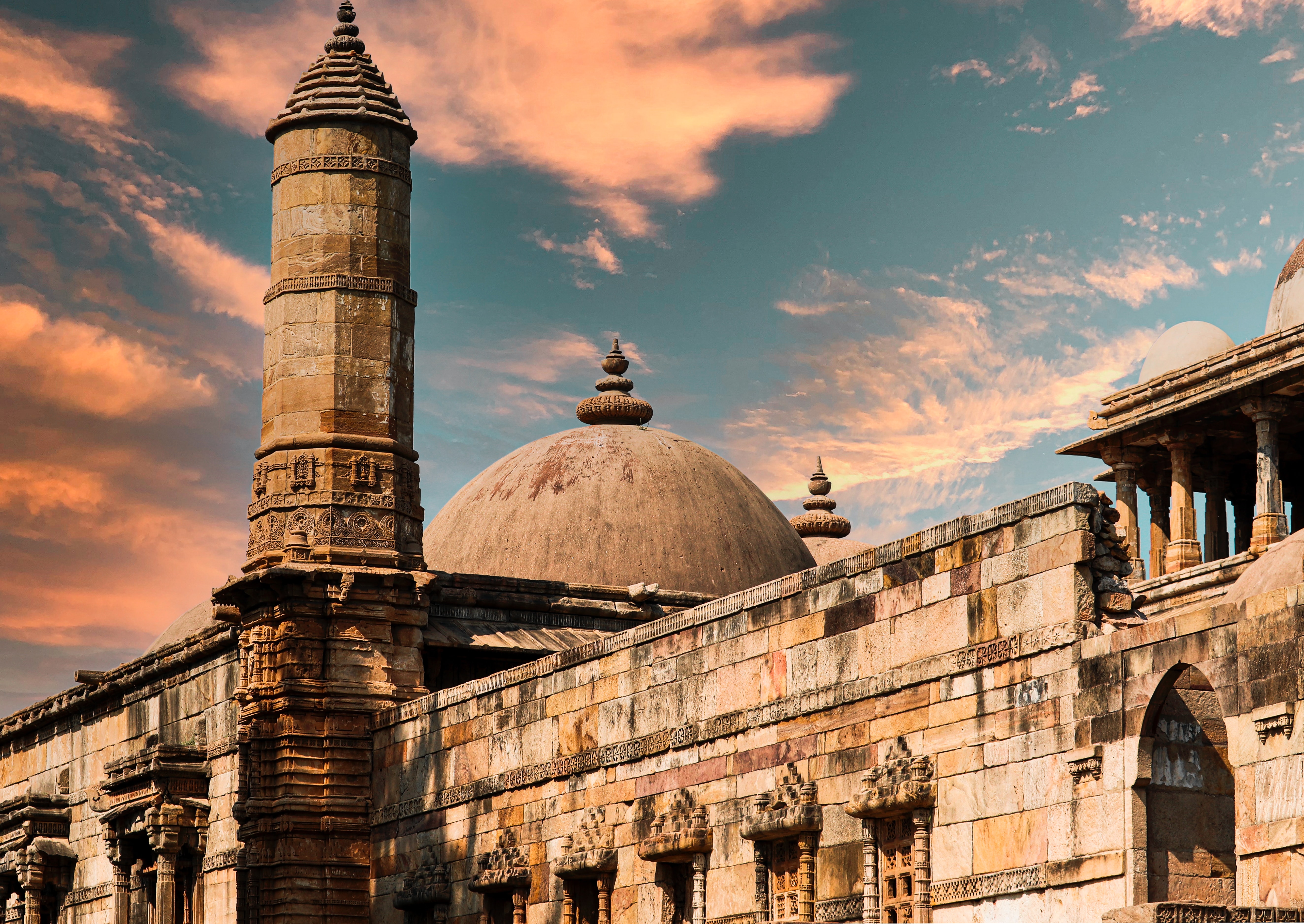
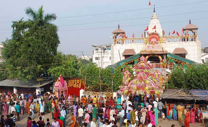
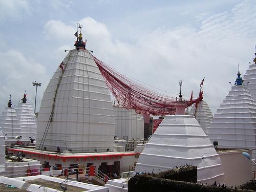
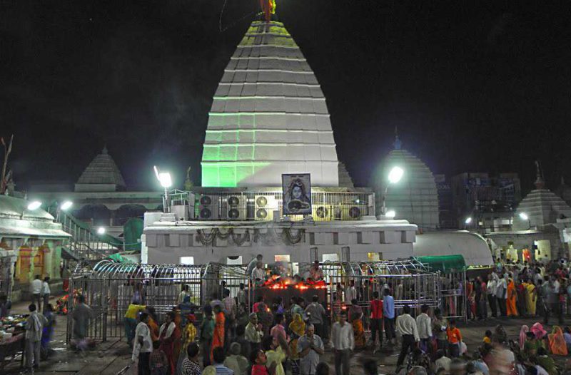
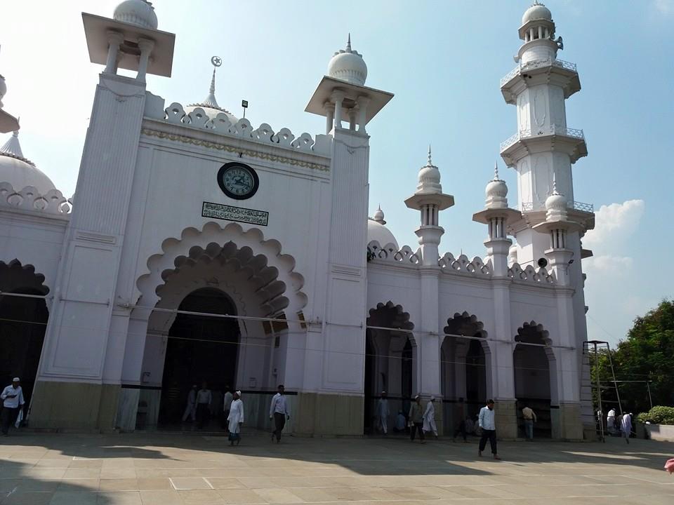
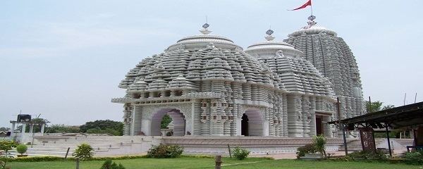
The Vaidyanath Temple is renowned for its architectural grace, blending spiritual symbolism with artistic finesse. The temple stands approximately 72 feet tall with a large shikhara or spire that invokes the symbolic lotus, a motif reflecting purity and spiritual awakening. The main temple houses the lingam in a sanctum sanctorum approachable by devotees through spacious courtyards enclosed by high white stone walls. The complex includes an array of 21 smaller shrines dedicated to various deities, enhancing its spiritual ecosystem. Intricate carvings and frescoes adorn the inner and outer walls, displaying scenes from Shiva’s legends, abstract floral motifs, and geometric designs inspired by medieval Mughal and Hindu architectural styles. The temple’s golden vessels atop the shikhara, donated by various patrons, glisten under sunlight, symbolising prosperity and devotion. Devotees often notice the distinctive thumbprint on the lingam, marking Ravana’s historical bond with the temple.

The temple’s spiritual rhythm is a blend of age-old rituals and dynamic pilgrim activity. The ritual bathing of the lingam with milk, water from holy rivers, ghee, honey, and sandalwood paste is performed multiple times daily, accompanied by chants and hymns. Sacred lamps, conches, and devotional songs fill the temple atmosphere morning and evening. Devotees present fruits, flowers, bilva leaves, and coconuts, seeking health, prosperity, and spiritual welfare. Maha Shivaratri is celebrated in a grand way at the temple with night-long vigils, chants, processions, and masses, drawing vast crowds regionally and nationally. The Shravan month heralds fervent fasting and increased devotion to mark this auspicious lunar month. The temple observes Kartik Purnima and other major Hindu festivals with fervour. Local priests and families maintain a continuous tradition of active worship and pilgrim support, blending spiritual guidance with social welfare.

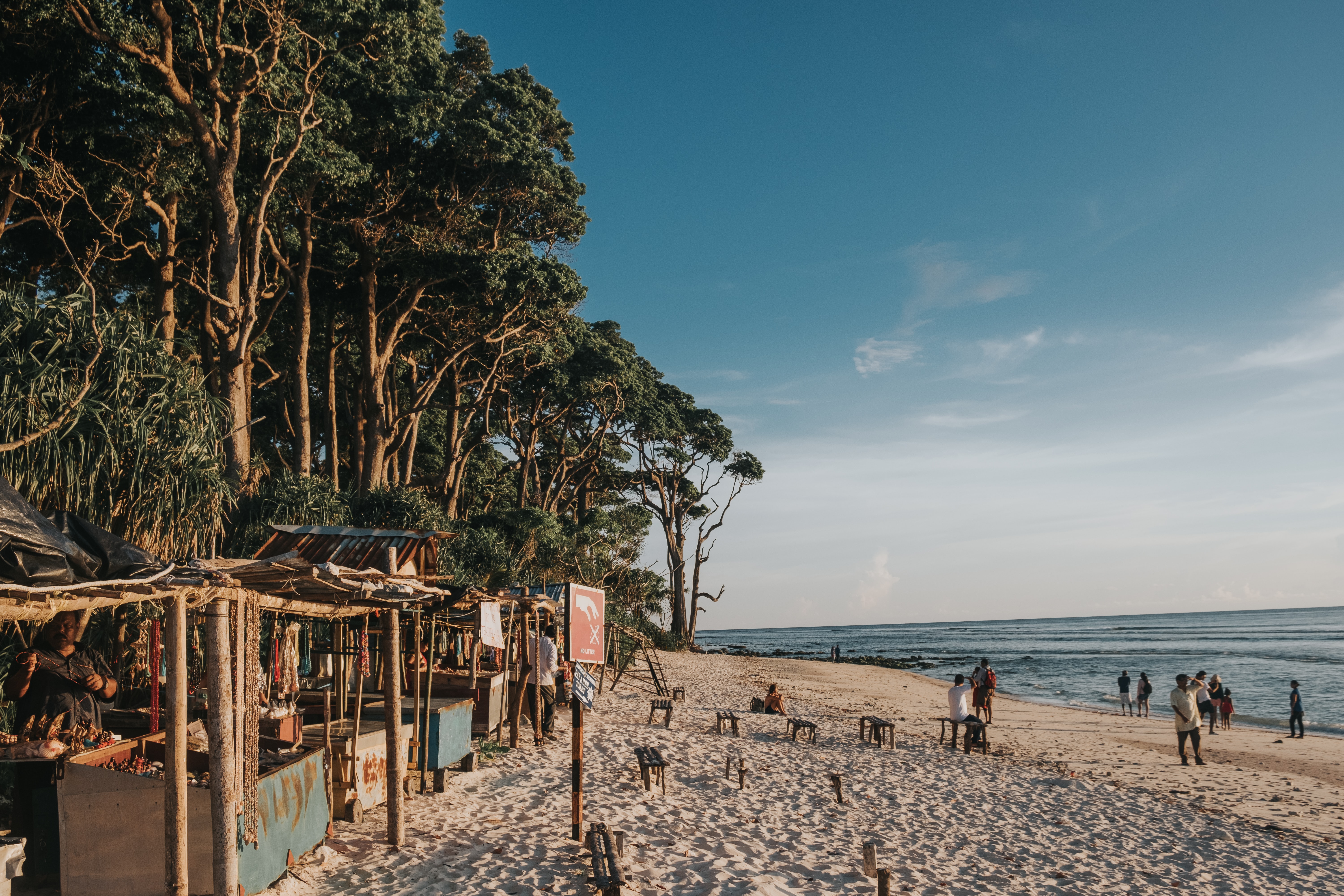
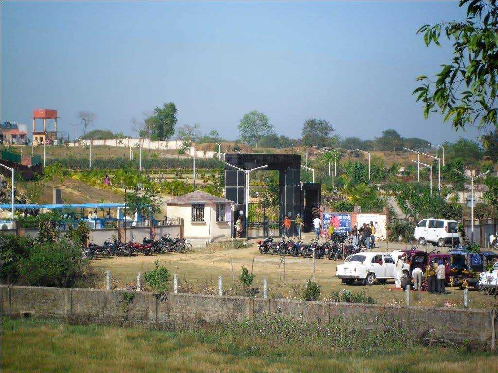
Pilgrimage to Vaidyanath is an immersive encounter with faith and nature. Deoghar town is well connected by road and rail, with nearest airports at Ranchi and Patna. Pilgrims often combine their visit with eastern India’s wider spiritual routes, including other Jyotirlingas and neighbouring shaktipeeths. Dharmashalas, hostels, and restaurants warmly welcome pilgrims, offering simple vegetarian foods and spiritual camaraderie. The temple’s atmosphere is enriched by surrounding greenery, gardens, and quiet spaces for meditation. Many pilgrims narrate personal stories of healing, familial blessings, and purification, attributing these blessings to the temple’s special healing power and divine energy.

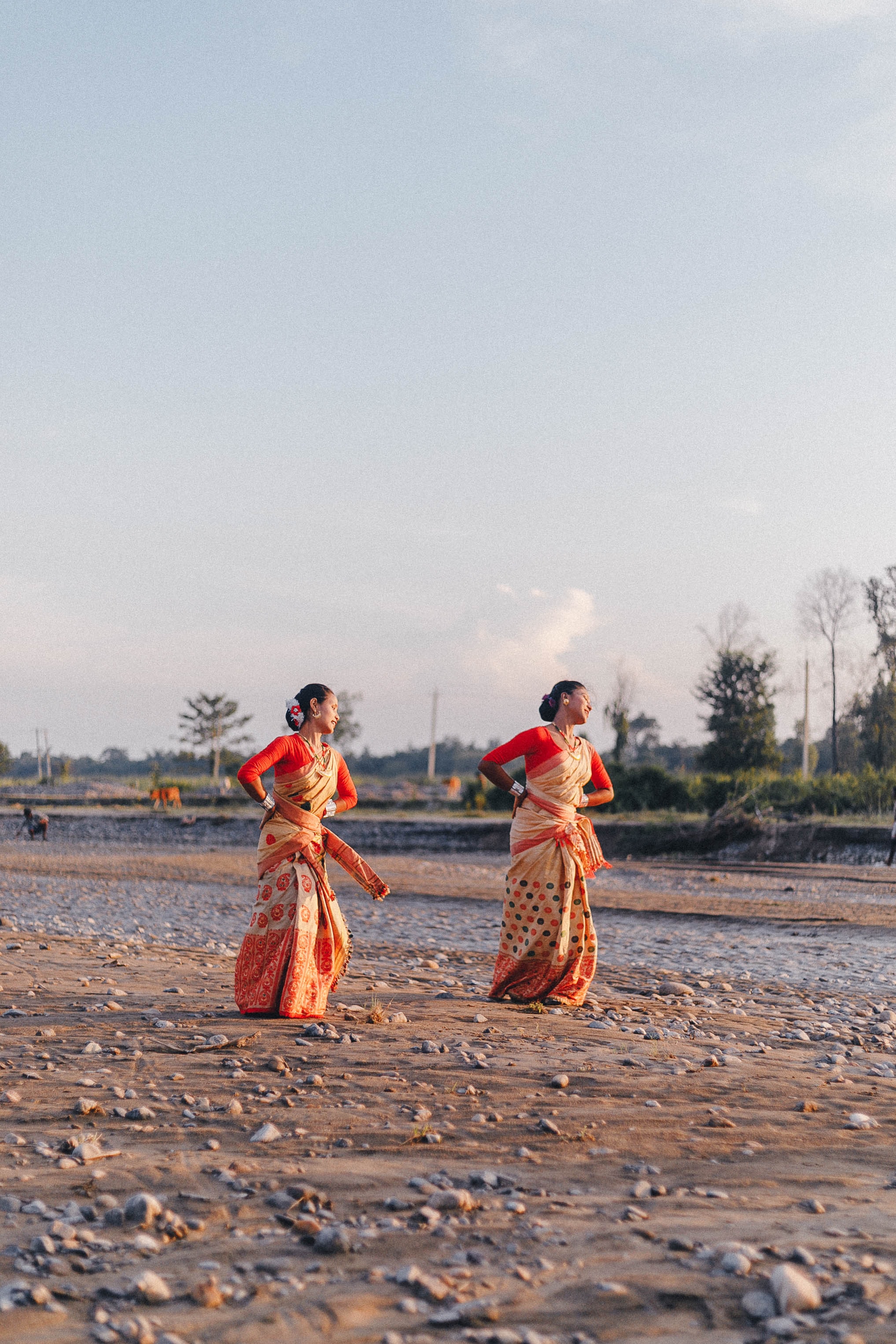
Vaidyanath’s influence permeates eastern Indian religious culture, arts, and communal life. Traced in Puranic texts and local folklore, the temple inspires bhakti poetry, devotional songs, and annual storytelling performances. Folk dramas and music performances during festivals narrate the story of Ravana’s penance and Shiva’s grace. Temple motifs influence local arts and crafts, including stone carving, textile weaving, and devotional iconography. The shrine serves as a cultural and spiritual anchor for Deoghar and the surrounding regions, uniting diverse communities through shared rituals and festivals.

Today, Vaidyanath Temple is a living centre of faith, tourism, and heritage preservation. The temple is administered by local trusts, ensuring the smooth conduct of worship, pilgrim services, and conservation efforts. Safety, sanitation, and infrastructure have been significantly upgraded to accommodate growing pilgrim numbers. Millions of pilgrims visit annually, especially during Maha Shivaratri and Shravan, bolstering the local economy and cultural visibility. Eco-tourism and heritage preservation efforts balance the influx with environmental concerns. Ongoing restoration works maintain the temple’s structural integrity and the vibrancy of its art and iconography.

Vaidyanath Temple in Deoghar stands as a luminous symbol of Shiva’s healing and compassionate power. The temple’s deep mythological roots, rich historical tapestry, and intricate architecture embody a sacred trust passed down through the ages. For countless pilgrims and devotees, Vaidyanath offers hope, health, and salvation, securing its place at the core of India’s spiritual geography. It remains a vital beacon within the Jyotirlinga circuit and a testament to the enduring bond between faith and healing.

Travel Bucket List: India – Consolidated List of all States

As I started planning my travel, I started relying on my research for where to go and found it slightly ungainly to search through all the material I have to reach a specific destination. So here’s a consolidated list of all Indian states, in alphabetical order with the cities and towns next to each part which makes it easier to get to the place you are interested in.

Photo by Ravigopal Kesari on Unsplash

Andaman and Nicobar Islands
Part 1 – Introduction and Overview
Part 2 – Port Blair
Part 3 – Corbyn’s Cove Beach, Wandoor Beach, Viper Island, Ross Island, North Bay Island, Red Skin Island, Middle Andaman Island, Long Island, Baratang Island, Parrot Island, North Passage Island, Guitar Island
Part 4 – Aves Island, North Andaman Island, Diglipur, Stewart Island, Ross & Smith Island, Jolly Buoy Island, Havelock Island
Part 5 – Neil Island, South Andaman Island, Rutland Island, Little Andaman Island, Cinque Island, Barren Island, Narcondom Island, Kathchal Island, Campell Bay & Indira Point
Part 6 – Mahatma Gandhi Marine National Park, Chidiya Tapu, The Chidiya Tapu Biological Park, Mount Harriet National Park, Saddle Peak National Park, Campbell Bay National Park, Galathea National Park, Middle Button Island National Park, North Button Island National Park, South Button Island National Park

Photo by Gowrisha CV on Unsplash

Andhra Pradesh
Part 1: Introduction and Overview, Vishakhapatnam
Part 2: Araku Valley, Vizianagaram, Annavaram, Samalkot, Kakinada, Rajahmundry
Part 3: Amaravathi, Vijayawada, Machilipatnam
Part 4: Guntur, Chirala, Nagarjunakonda, Srisailam, Cumbum, Nellore
Part 5: Kurnool, Mantralayam, Gandikota, Tadipatri, Anantapur, Puttaparthi
Part 6: Lepakshi, Horsley Hills, Chittoor, Srikalahasthi, Tirupati

Photo by Mayur More on Unsplash

Arunachal Pradesh
Part 1: Introduction and Overview, Itanagar, Bhalukpong
Part 2: Bomdila, Tawang
Part 3: Ziro, Yinkiong, Mechuka, Roing, Tirap
Part 4: Khonsa, Changlang, Miao, Anini, Pasighat, Aalo, Daporijo, Anjaw, Tezu

Photo by Nilotpal Kalita on Unsplash

Assam
Part 1: Introduction and Overview, Guwahati, Dispur
Part 2: Kokrajhar, Bongaigaon, Goalpura, Barpeta, Nalbari, Hajo, Sualkuchi
Part 3: Darrang, Mayong and Morigaon, Nagaon, Tezpur, Jorhat
Part 4: Sivasagar, Majuli, Dhemaji, Dibrugarh, Tinsukia, Digboi
Part 5: Sadiya, Haflong, Jatinga, Diphu, Karimganj, Hailakandi, Silchar
Part 6: Raimona National Park, Manas National Park, Orang National Park, Kaziranga National Park, Nameri National Park, Dibru Saikhowa National Park, Dihing Patkai National Park

Photo by ARTO SURAJ on Unsplash

Bihar
Part 1: Introduction and Overview
Part 2: Patna
Part 3: Hajipur, Nalanda
Part 4: Rajgir, Sasaram, Kaimur
Part 5: Bodh Gaya, Vaishali
Part 6: Muzzafarpur, Sitamarhi, Madhubani, Lauriya Nandangarh, Bhagalpur, Valmiki National Park Tiger Reserve and Wildlife Sanctuary

Photo by Ayiman Mohanty on Unsplash

Chhattisgarh
Part 1: Introduction and Overview, Raipur, Champaran
Part 2: Bhilai, Durg, Rajnandgaon, Chirmiri, Madku Dweep, Bhoramdeo Temple, Guru Ghasidas National Park
Part 3: Achanakmar Tiger Reserve, Bilaspur, Raigarh, Korba, Ambikapur, Barnawapara Wildlife Sanctuary, Mainpat, Malhar
Part 4: Mahasamund, Sirpur, Rajim, Jagdalpur, Dhamtari, Dhamtari, Dantewada, Kanger Ghati National Park

Dadra and Nagar Haveli and Daman and Diu
Part 1: Introduction and Overview, Daman
Part 2: Diu
Part 3: Dadra and Nagar Haveli

Delhi
Part 1: Introduction and Overview, India Gate, Red Fort, Qutub Minar, Jantar Mantar, Rajghat
Part 2: Iron Pillar, National War Memorial, Rajpath, Rashtrapati Bhavan, Agrasen Ki Baoli, Ghalib Ki Haveli, Alai Darwaza/Minar, Bhool Bhulaiya ka Mahal, Purana Qila,
Part 3: Tughlaqabad Fort. Siri Fort, Feroza Kotla Fort, Swaminarayan Akshardham Temple, ISKON Mandir, Birla Temple, Chhatrapur Temple, Kalkaji Temple, Kali Bari Temple, Yogmaya Temple, Sri Digambar Jain Lal Mandir, Lotus Temple
Part 4: Jama Masjid, Quwwat-ul-Islam Mosque, Fatehpuri Masjid, Jamali Kamali Mosque and Tomb, Nizamuddin Dargah, Humayun’s Tomb, Safdarjung’s Tomb, Isa Khan’s Tomb, Hijron ka Khanqah, Nicholson Cemetery
Part 5: Gurudwara Bangla Sahib, Gurudwara Sis Ganj Sahib, Rakab Ganj Gurdwara, Sunder Nursery, Lodhi Gardens, Garden of Five Senses, National Rose Garden, Mehrauli Archaeological Park, Pradhanmantri Sangrahalaya, National Museum, Nehru Memorial Museum and Library, Rashtrapati Bhavan Museum, Indian War Memorial Museum, National Handicrafts Museum
Part 6: Indira Gandhi Memorial Museum, Sanskriti Museums, Charkha Museum, Sulabh International Museum of Toilets, Shankar’s International Dolls Museum, Museum of Archaeology, National Railway Museum, Museo Camera, National Gallery of Modern Art, Kiran Nadar Museum of Art, Museum of Illusions, National Zoological Park, National Bal Bhavan, Connaught Place, Chandni Chowk, Dilli Haat, Sarojini Market, Lajpat Nagar, Majnu ka Tila, Pragati Maidan

Photo by Sarang Pande on Unsplash

Goa
Part 1: Introduction and Overview
Part 2: North Goa, Vagator Beach, Anjuna Beach, Calangute Beach, Sinquerim Beach, Candolim Beach, Arambol Beach, Mandrem Beach, Morjim Beach, Miramar Beach, Siridao Beach, Bogdeshwara Temple, Mangeshi Temple, Mahalaxmi Temple, Fort Aguada, Chapora Fort, Reis Magos Fort, Basilica of Bom Jesus, Church of Our Lady of Immaculate Conception, Chapel of St. Catherine, Church of Mae De Deus, Goa State Museum, Houses of Goa Museum, Museum of Christian Art, Casino Palms, Chorao Island, Harvalem Waterfalls
Part 3: South Goa, Butterfly Beach, Betalbatim Beach, Agonda Beach, Mobor Beach, Hollant Beach, Palolem Beach, Cansaulim Beach, Colva Beach, Talpona Beach, Kakolem Beach, Benaulim Beach, Our Lady of Remedios Church, Saviour of the World Church, St. Alex Church, Shantadurga Temple, Tambdi Surla Mahadev Temple, Chandreshwar Bhoothnath Temple, Naval Aviation Museum, Goa Chitra Museum, Big Foot Museum, The Grande Island, Pequeno Island, Bhagwan Mahaveer Wildlife Sanctuary, Netravali Wildlife Sanctuary, Cotigao Wildlife Sanctuary, Dudhsagar Falls, Bamanbudo Waterfalls, Netravali Bubbling Lake, Cabo de Rama Fort, Chandor

Photo by Parth Kateliya on Unsplash

Gujarat
Part 1: Introduction and Overview
Part 2: Surat, Vapi, Udvada, Valsad, Bilimora, Navsari, Bharuch, Saputara
Part 3: Ahmedabad, Lothal, Vadodara, Anand
Part 4: Gandhinagar, Patan, Mehsana, Palanpur
Part 5: Rajkot, Jamnagar, Dwarka, Porbandar, Junagadh, Bhavnagar, Palitana,
Part 6: Kutch, Bhuj, Mandvi, Rann of Kutch, Anjar

Photo by Sooraj Dev on Unsplash

Haryana
Part 1: Introduction and Overview, Gurugram, Manesar, Sohna
Part 2: Faridabad, Nuh, Murthal, Rohtak, Meham
Part 3: Hisar, Panipat, Karnal
Part 4: Kurukshetra, Ambala
Part 5: Panchkula, Morni Hills, Narnaul

Photo by Naman Pandey on Unsplash

Himachal Pradesh
Part 1: Introduction and Overview, Shimla, Kufri, Fagu, Theog, Hatkoti Valley, Chanshal Valley
Part 2: Chail, Solan, Barog, Nahan, Sirmour, Paonta Sahib, Shoghi, Kasauli, Arki, Nalagarh, Dadasiba, Bilaspur, Dalhousie,
Part 3: Kangra, Khajjiar, Bharmour, Chamba, Tattapani, Jalori Pass, Jibhi, Mandi
Part 4: Trithan Valley, Bhuntar, Sainj Valley, Barot, Bir Billing, Palampur, Kasol, Nagar, Manikaran Sahib, Tosh, Parvati Valley
Part 5: Kullu, Manali, Dharamsala, McLeodganj
Part 6: Keylong, Pin Valley National Park, Spiti Valley, Narkanda, Mashroba, Kinnaur, Sarahan, Sangla Valley, Kalpa, Pangi Valley, Nako

Jammu & Kashmir and Ladakh
Part 1: Introduction and Overview, Kashmir, Srinagar, Gulmarg, Sonmarg, Pahalgam, Amarnath, Pulwama, Kupwara, Poonch, Anantnag, Baramulla, Dachigam National Park
Part 2: Jammu, Patnitop, Rajouri, Udhampur, Kathua, Katra, Vaishno Devi, Kishtwar
Part 3: Ladakh, Leh, Leh Palace, Thiksey Gompa, Pangong Lake, Magnetic Hill, Nubra Valley and Khardung La Pass, Kargil, Drass, Hemis High Altitude Wildlife Sanctuary, Lamayuru, Lake Tso Moriri

Photo by Aryan Singh on Unsplash

Jharkhand
Part 1: Introduction and Overview, Ranchi
Part 2: Hazaribagh, Bokaro Steel City
Part 3: Jamshedpur, Neterhat
Part 4: Dhanbad, Shikarji, Deoghar, Dumka

Karnataka
Part 1: Introduction and Overview
Part 2: Bengaluru
Part 3: Mysuru, Mangalore, Belgaum
Part 4: Hubli-Dharwad, Gulbarga, Bidar, Badami, Bijapur, Hassan, Shimoga, Hampi, Sharavathi Valley Wildlife Sanctuary, Bhadra Wildlife Sanctuary, Brahmagiri Wildlife Sanctuary, Nagarhole National Park, Bandipur National Park, Ranganathittu Bird Sanctuary, Jog Falls, Shivanasamudra Falls, Kodasalli Backwater
Part 5: Coorg, Chikmagalur, Sakleshpur, Kudremukh, Kemmanagundi, Kotagiri, Masinagudi, Devarayanadurga, Karwar, Devbagh, Kumta, Netrani Island, Murudeshwar, Maravanthe, St. Mary’s Island, Udipi
Part 6: Udipi, Kollur, Sringeri, Dharmasthala, Horanadu, Talakadu, Belur, Shravanbelagola, Gokarna, Murudeshwar, Koodli, Srirangapatna, Pattadakal, Aihole, Kalasa

Kerala
Part 1: Introduction and Overview
Part 2: Kasaragod, Kannur, Kozhikode
Part 3: Wayanad, Mallapuram, Palakkad
Part 4: Thrissur, Ernakulam, Alappuzha
Part 5: Kottayam, Idukki, Patanamthitta
Part 6: Kollam, Tiruvanathapuram

Photo by Sachin Benny on Unsplash

Lakshadweep Islands
Part 1: Introduction and Overview
Part 2: Aminidivi, Cora Divh, Sesostris Bank, Bassas de Pedro, Cherbaniani Reef, North Islet, Byramgore Reef, Chetlat Island, Bitra Par, Kilthan Island, Kadmat Island, Kadmat Beach, Elikalpeni Bank, Perumal Par, Amini Island
Part 3: Laccadive, Amindivi, Agatti Island, Bangaram, Pakshipitti, Andrott Island, Kavaratti, Kalpeni, Suheli Par
Part 4: Minicoy, Maliku Atoll, Investigator Bank, Viringili

Madhya Pradesh
Part 1: Introduction and Overview
Part 2: Bhopal
Part 3: Indore, Ujjain, Alampur
Part 4: Maheshwar, Omkareshwar, Mandu, Burhanpur
Part 5: Chanderi, Shivpuri, Orchha, Khajurao
Part 6: Gwalior, Jabalpur, Bhedaghat, Panchmarhi, Amarkantak, Bandhavgarh National Park, Kanha National Park, Pench National Park

Photo by Raj Rana on Unsplash

Maharashtra
Part 1: Introduction and Overview, Mumbai
Part 2: Pune
Part 3: Matheran, Lonavala, Khandala, Rajmachi, Lavasa, Kamshet, Mahabaleshwar, Panchgani, Kaas Plateau, Maval, Bhandardara, Chikhaldara, Bhimashankar
Part 4: Amravati, Aurangabad, Ajanta and Ellora Caves, Lonar, Chiplun, Kolhapur, Nagpur, Nanded, Nashik, Triambakeshwar, Shirdi, Shani Shinganapur, Raigad, Ratnagiri, Satara
Part 5: Dahanu, Alibaug, Kashid, Diveagar, Harihareshwar, Murud, Karade, Ganpatipule, Tarkarli, Vengurla, Tadoba National Park, Bhamragarh Wildlife Sanctuary, Chandoli National Park, Gugumal National Park, Navegaon National Park, Malvan Marine Sanctuary, Rehekuri Blackbuck Sanctuary

Photo by WAIKHOM JAMES on Unsplash

Manipur
Part 1: Introduction and Overview, Imphal
Part 2: Moirang, Tamenglong, Thoubal
Part 3: Chandel, Tengnoupal, Moreh, Kaina, Ukhrul, Mount Koubru, Baruni Hill, Thangjing Hill, Sadu Chiru Waterfall

Photo by Utkarsh B on Unsplash

Meghalaya
Part 1: Introduction and Overview
Part 2: Shillong
Part 3: Mawphlang, Cherrapunji, Nongpoh, Mawsynram
Part 4: Jowai, Mawlynnong, Dawki, Balpakram National Park, Williamnagar, Baghmara, Tura
Part 5: Khasi Hills, Jaintia Hills, Garo Hills

Photo by Vanlaldin puia on Unsplash

Mizoram
Part 1: Introduction and Overview, Aizwal, Falkawn Village
Part 2: Reiek, Hmuifang, Kolasib, Tamdil or Tam Lake, Mamit, Vantawng Falls, Serchhip
Part 3: Dampa Tiger Reserve, Lunglei, Champhai
Part 4: Murlen National Park, Phawngpui, Phawngpui National Park, Saiha,

Photo by Suraj Jadhav on Unsplash

Nagaland
Part 1: Introduction and Overview, Dimapur
Part 2: Kohima
Part 3: Mokokchung, Tuensang, Phek, Mon, Pfutsero

Photo by Ayiman Mohanty on Unsplash

Odisha
Part 1: Introduction and Overview, Bhubaneshwar, Dhauli
Part 2: Cuttack, Rayagada, Daringbadi, Berhampur, Jeypore
Part 3: Puri, Baripada, Sambalpur, Rourkela
Part 4: Konark, Paradeep, Gopalpur, Chandipur
Part 5: Lake Chilika, Tikarpada Wildlife Sanctuary, Satkosia Tiger Reserve, Bhitarkanika National Park & Wildlife Sanctuary, Simlipal National Park, Duduma Waterfalls, Chandaka Forest, Kotgarh Elephant Reserve, Karlapat Wildlife Sanctuary

Photo by nullvoid on Unsplash

Puducherry
Part 1: Introduction and Overview, Puducherry
Part 2: Karaikal, Mahé, Yanam

Photo by Prerna Sharma on Unsplash

Punjab
Part 1: Introduction and Overview
Part 2: Chandigarh, Sirhind
Part 3: Rupnagar, Patiala
Part 4: Ludhiana, Bhatinda
Part 5: Jalandhar, Kapurthala
Part 6: Pathankot, Amritsar

Rajasthan
Part 1: Introduction and Overview, Jaipur, Udaipur
Part 2: Jodhpur, Jaisalmer, Sawai Madhopur, Pushkar

Photo by Apurba Nag on Unsplash

Sikkim
Part 1: Introduction and Overview
Part 2: Gangtok
Part 3: Tinkitam Rayong, Namchi, Barsey Rhododendron Sanctuary, Kabi Longstok, Tendong Hill, Aritar, Zuluk, Pangolakha Wildlife Sanctuary, Pelling, Yuksom, Ravangla
Part 4: Maenam Wildlife Sanctuary, Geyzing, Yangtey, Borong, Mangan, Chopta Valley, Lachung, Lachen, Yumthang Valley, Thangu Valley, Gurudongmar Lake, Cholamu Lake, Shingba Rhododendron Sanctuary, Khangchendzonga National Park, Fambong Lho Wildlife Sanctuary, Goecha La

Tamil Nadu
Part 1: Introduction and Overview, Chennai
Part 2: Coimbatore, Tiruchirappalli, Tiruppur, Tirunelveli
Part 3: Ooty, Kodaikanal, Yercaud, Coonoor, Yelagiri, Bellikkal
Part 4: Kanchipuram, Tiruvannamalai, Chidambaram, Vaitheeshwaran Kovil,
Part 5: Kumbakonam, Thanjavur, Swamimalai, Rameshwaram, Madurai
Part 6: Mahabalipuram, Kanyakumari, Mudumalai Wildlife Sanctuary, Hogenakkal Falls, Kutralam Falls

Photo by Aman Upadhyay on Unsplash

Telangana
Part 1: Introduction and Overview, Hyderabad Part 1
Part 2: Hyderabad Part 2
Part 3: Secunderabad
Part 4: Warangal, Nizamabad
Part 5: Khammam, Karimnagar, Adilabad, Mahbubnagar, Medak
Part 6: Nalgonda, Bhadrachalam, Koti Linga, Somasila, Vemulawada

Photo by Sourav Debnath on Unsplash

Tripura
Part 1: Introduction and Overview
Part 2: Agartala
Part 3: Kailashahar, Unakoti, Udaipur, Ambassa, Pilak Archaeological Sites, Chabimura, Mahamuni Pagoda, Manubankul, Buddhist Stupa, Boxanagar
Part 4: Baramura Eco Park, Kalapania Nature Park, Tepania Eco Park, Khumulwang Eco Park, Jampui Hills, Dumboor Lake, Dhalai, Rudrasagar Lake, Sepahijala Wildlife Sanctuary & Clouded Leopard National Park, Trishna Wildlife Sanctuary, Rajbari National Park, Rowa Wildlife Sanctuary, Gomati Wildlife Sanctuary

Uttar Pradesh
Part 1: Introduction and Overview, Noida, Loni, Ghaziabad, Meerut, Muzzafarnagar
Part 2: Hastinapur, Vrindavan, Mathura
Part 3: Fatehpur Sikri, Agra, Garhmukteshwar
Part 4: Aligarh, Firozabad, Jhansi, Piilbhit, Bithoor, Naimisharanya
Part 5: Kanpur, Lucknow
Part 6: Ayodhya, Sravasti, Prayagraj
Part 7: Chitrakoot, Vindhyachal, Varanasi, Sarnath, Kushinagar

Photo by Akshay syal on Unsplash

Uttarakhand
Part 1: Introduction and Overview, Dehradun
Part 2: Mussoorie, Dhanaulti
Part 3: Auli, Joshimath, Chopta, Tungnath, Ukhimath, Lansdowne, Nainital
Part 4: Sattal, Bhimtal, Naukuchiatal, Kausani, Ranikhet, Almora, Binsar, Jalna, Kasar Devi, Jageshwar, Champawat, Munsiyari, Pithorgarh
Part 5: Bageshwar, Chamoli, Mana, Badrinath, Pandukeshwar, Hemkund Sahib, Kedarnath, Gomukh, Madhyamaheshwar, Gangotri, Gauri Kund, Yamunotri
Part 6: Rudranath, Guptakashi, Nandprayag, Rudraprayag, Devprayag, Rishikesh, Haridwar, Roopkund Lake, Nelong Valley, Gangotri National Park, Kedarnath Wild Life Sanctuary, Valley of Flowers, Nanda Devi National Park, Govind Pashu Vihar Wildlife Sanctuary, Rajaji National Park, Jim Corbett National Park

Photo by Nitish Narayan on Unsplash

West Bengal
Part 1: Introduction and Overview, Kolkata
Part 2: Howrah, Barrackpore, Chandan Nagar, Chinsurah, Bardhaman, Haldia, Midnapore
Part 3: Shantiniketan, Durgapur, Jhargram, Asansol, Murshidabad, Mukutmanipur, Malda, Siliguri, Jalpaiguri, Cooch Behar, Bagdogra
Part 4: Kurseong, Mirik, Darjeeling, Tinchuley, Dooars, Kalimpong
Part 5: Rishyap, Lava and Lolegaon, Buxa Tiger Reserve, Rajabhatkawa, Jaldapara National Park, Jaldhaka, Chapramari Wildlife Sanctuary, Gorumara National Park, Neora Valley National Park, Lataguri, Purulia, Sonajhuri Forest, Deulti, Sundarbans, Mayapur, Nabadwipa, Bakreswar
Part 6: Bankura, Bishnupur, Jayrambati, Kamarpukur, Tarapith, Falta, Raichak, Taki, Piyali Island, Machranga Dwip, Kakdwip, Mousuni Island, Bakkhali, Junput, Mandarmani, Tajpur, Shankarpur

Travel Bucket List: India – Jharkhand Part 4

Dhanbad

Jharkhand’s second most populous city after Jamshedpur, Dhanbad is located about 161 km northeast of Ranchi and about 300 km northeast of Netarhat. Located very close to the state’s border with West Bengal, Dhanbad is also called the Coal Capital of India for housing one of the largest coal mines in India. The prestigious Indian School of Mines, now IIT Dhanbad is also situated in Dhanbad. 

Dhanbad was originally part of the Manbhum region and occupied by Mundari tribals in the wilderness of south undivided Bihar. The region has thick forests, rich mineral resources, and a mixed demographic profile, including Adivasis, particularly the Santals and the Mundas before the city was established. The discovery of rich deposits of coal in the region caused the city to flourish financially, but also bought the notorious coal mafia and gang wars which continues to date. Dhanbad has one of the oldest and largest markets in the region and is also a centre of large scale industries. The city is surrounded by about 112 coal mines with a total production of 27.5 million tonnes and an annual income of 7,000 million rupees through the coal business.

Shakti Mandir is located in the heart of the city and is dedicated to Goddess Durga. The temple hosts the Akhand Jyoti or the eternal flame which is brought down from Vaishno Devi. The temple is crowded on festive occasions and every Tuesday and Friday. The Lillori Sthan Mandir, dedicated to Goddess Kali is an important temple situated on the banks of the River Katri at a distance of 18.5 km from Dhanbad. This region is said to be under the protection of Goddess Kali with many rituals performed and festivals celebrated in Dhanbad located at this temple.

The Topchanchi Lake is an artificial lake upon which a dam was built to supply water to Dhanbad and its suburbs. The lake covers over 214 acres and is located about 37 km from the city amidst rolling green hills and forests. The famous Prasanath Hills are also nearby. A small part of the lake environs is dedicated to a wildlife sanctuary. The Bhatinda Falls is a powerful waterfall that cascades over rock formations. Also known as the waterfall of Moonidih, it is located about 14 km from Dhanbad and makes for an excellent picnic spot. The falls are lined by huge boulders and make for an awe-inspiring sight.

Maithon Dam on the banks of the River Borakar is a beautiful location about 48 kilometres from the main city. The dam is built by the Damodar Valley Corporation upon a river that expands to 65 sq km and is 15,712 feet long and 165 feet high. The dam is unique by being a one of a kind underground power station in Asia and also requires permission to get into and provides guided tours for visitors. Boating can be enjoyed at the dam year-round and has amazing views of the sunset. There is a deer park close by as well as the Maithon Hydel Power Plant, Asia’s first underground hydel power plant. Accessible by boats, Chammach Pahad is a beautiful island with the shape of a giant inverted spoon. Dedicated to the Goddess Kalyaneshwari, the Kalyaneshwari Temple has multitudes of women praying to have a child. The temple is hundreds of years old and is surrounded by natural beauty. Christmas and New Year are the best times to visit the Phoolbagan & Millennium Parks, located below the Maithon Dam, as flower shows are organised during this time.

Panchet Dam is the last to be built out of the four multi-purpose dams that were constructed under the Damodar Valley Corporation and was opened in 1959. The dam gets its name from the nearby Panchet Hill that rises above the dam. Built across the Damodar River which forms a natural border between Jharkhand and West Bengal, Panchet Dam is constructed above the confluence of the Barakar and Damodar Rivers and so the northern bank of the reservoir falls in Jharkhand and the southern bank under West Bengal. The village of Telkupi, dating back to the 1st century and home to various ancient Jain temples as well as the capital of the erstwhile Tilakampa Kingdom was submerged under the dam area. However, some temples and the fort of the Singh Deo dynasty of Panchakot remain which tourists can visit as well as the ruins of the Old Terracotta temple in the Garpanchkot hills. At a drive of half an hour from the dam is the beautiful Garpanchkot at the foothills of the Panchet Hill. Home to the ruins of the temple and the historic fort, a visit to Garpanchkot is recommended while visiting the dam.

The Birsa Munda Park is Dhanbad’s sole park and a major tourist attraction spread over 21 acres with a walking path, lawns, a canteen, a playground and toy rides for children. Opened in November 2009, the park is often regarded as the stepping stone to various other projects that are coming up in the city. The park is open from 6 to 8 am and then again between 9 am to 7 pm with a free entry during the 6 to 8 am slot. For the later slot, the entry charges vary from INR 5 for children between 5 to 12 years to INR15 for adults during the week and INR 10 for children and INR 20 for adults on the weekends.

Shikarji

Located on Parasnath Hill, the highest mountain in Jharkhand, Shikharji is one of the holiest pilgrimage sites for Jains. It is believed that here is where twenty of the twenty-four Jain Tirthankaras had attained moksha or freedom from the cycle of rebirth, along with several other monks which makes it one of the most important and holy sites for Jain pilgrims, from both the Digambara and Svetambara sects. Rising to a height of 1,350 m Shikarji is the highest mountain in the state. It lies about 168 km northeast of Ranchi and about 55 km slightly north of Dhanbad.

Shikharji which means the venerable peak is also called Sammed Sikhar or the peak of concentration because this is where twenty of twenty-four Tirthankaras attained Moksha through meditation. The word Parasnath is derived from Parshvanatha, the twenty-third Jain Tirthankara, who was one of those who is believed to have attained Moksha here. Shikharji along with Ashtapada, Girnar, the Dilwara Temples of Mount Abu and Shatrunjaya are known as the Svetambara Pancha Tirth or the five principal pilgrimage shrines.

The earliest reference to Shikharji as a place of pilgrimage is found in the Jnatrdharmakatha, one of the twelve core texts of Jainism. Vastupala, the prime minister during the reign of King Vīradhavala and Vīsaladeva of the Vaghela dynasty, constructed a Jain temple housing 20 idols of Tirthankaras as well as images of his ancestors and Samavasarana. During Mughal rule, Emperor Akbar in 1583 had passed an edict granting the management of Shikharji Hill to the Jain community to prevent the slaughter of animals in the vicinity.

There are many temples at the foot of the Shikharji temple that are also frequented by tourists and pilgrims. The section between the summit of the mountain and the Gandharva Nala stream is a very religious and holy place for Jains. The current structure of temples at Shikharji was re-built by Jagat Seth in 1768, however, the idol itself is very old. The Sanskrit inscription at the foot of the image is dated 1678 with one shrine dating to the 14th century.

At the base of Shikharji is a temple to Bhomiyaji or Taleti. On the walls of the Jain temple at the village of Madhuban, there is a mural painting depicting all the temples on Parasnath Hill. The Svetambara Bhaktamara temple, established by Acharya Ramchandrasuri, is the first temple to house a Bhaktamara Stotra Yantra. A large Digambar Jain temple depicting Nandishwar Dweep is at the base of the hill. The Nichli temple, built by a Calcutta merchant in the 18th century, is noteworthy for its architecture and features arched gateways and carvings of Tirthankaras on the temple walls. There are 31 tonks each which enshrines footprints, in black or white marble, of a Tirthankara with the Parshvanatha tonk at the summit of the hill. The chatra distinguishes the Parshvanatha footprint from the footprints of the other 23 Tirthankaras which do not have chatras and are indistinguishable from each other. Since these temple does not have images these tonks are worshipped by both the Digambara and Svetambara sects. Visitors may also try adventure sport activities like parasailing and paragliding.

Deoghar

A holy city, sacred to Hindus, Deoghar lies about 250 km northeast of Ranchi and about 100 km northeast of Shikharji. Also known as Jharkhand’s cultural capital, Deoghar is famous for the Baidyanath Temple. Deoghar is situated on the banks of the River Ajay and its tributary, the River Dadhawa. It is a part of the Indian peninsular plateau which forms a part of the oldest landmass on earth, Gondwana Land.

The Baidyanath Temple is one of the 12 Jyotirlingas sites.  Deoghar is a Hindi word and means the abode of Gods and Goddesses. The origins of the Baidyanath Dham are lost in antiquity, but it has been referred to as Haritakivan or Ketakivan in Sanskrit texts. The name Deoghar seems to be of recent origin and probably dates to the construction of the temple of Lord Baidyanath. Although the name of the builder of the temple is not traceable, certain parts of the front portion of the temple are said to have been built by Puran Mal, an ancestor of the Maharaja of Giddhour, in 1596. The temple is dedicated to Lord Shiva and so during the month of Shravan, around July and August,  many devotees take the water of the River Ganga in pitchers called Kanwads, hence known as Kanwariyas, to perform the holy ritual of Rudrabhishek or the holy bath from Sultanganj to Deoghar for worship and it is believed they get what they desire in life. Deoghar, along with Srisailam, is one of the few places in India where the Jyotirlinga and the Shaktipeeth are together, lying side beside each other.

There is an old story that is a part of this temple’s origins. When King Ravana of Lanka, felt his capital would be incomplete and under the constant threat of enemies unless and until Mahadeva or Lord Shiva decides to stay forever; he offered constant prayers to the Lord. Pleased, Lord Shiva permitted Ravana to carry his Atmalinga along with him to Lanka on the condition that there neither should be a break on the journey to Lanka nor should the lingam be transferred to any other person. If this were to happen, the lingam would remain fixed at that place forever where it was deposited. The other Gods were against this plan because they knew that if Lord Shiva went to Lanka with Ravana, his evil deeds would threaten the entire world. So they requested Lord Varuna, the God of Water, to enter Ravana’s belly on his way back. When the Lord did so, Ravana felt a severe urge to release water, and he handed over the lingam to a Brahmin, who was Lord Ganesha in disguise. The Brahmin placed the lingam at this location, which is now known as Baidyanath Dham. Ravana tried hard to remove the lingam from the spot where it had been placed and his frustration at being unable to do so made him retort to violence, and he damaged the lingam in the process. His guilt then made him visit the spot daily, and this continued forever. The place where Lord Shiva descended earth is known as Harilajori, which is close to Baidyanath.

The large and magnificent temple complex comprises the main temple of Baba Baidyanath, where the Jyotirlinga is installed, along with twenty-one other significant and beautiful temples. The temple of Baidyanath or Lord Shiva is the most important of all the temples in the courtyard. The temple is said to have been built by Vishwakarma, the architect of the Gods. The temple is divided into three parts: the main temple, the middle part of this main temple, and the entrance to the temple. This 72 feet high temple is east facing and is shaped like a lotus. The top consists of three ascending shaped gold vessels that were donated by the Maharaja of Gidhaur, Raja Puran Singh. Besides these vessels is a ‘Punchsula’, which is five knives in a Tridenta shape, and an eight-petalled lotus jewel, known as Chandrakanta Mani. The central lingam is about 5 inches in diameter and projects about 4 inches from the centre of a large slab with the top of the lingam broken. The temple of Goddess Parvati is tied to the main temple using red sacred threads and this unique feature symbolises the unity of Shiva and Shakti. Rituals begin at 4 am and continue till 3:30 pm, after which the temple is closed. The temple is then opened again at 6 pm and closes at 9 pm.

The Naulakha Mandir is 1.5 km from the main Baidyanath Temple and is dedicated to Lord Krishna and Goddess Radha. The name Naulakha is from the cost of the temple which was nine lakhs or 900,000 rupees. The temple which is 146 ft high, is very similar to the Ramakrishna Temple in Belur. The temple was built on the donations of Rani Charushila of the Pathuria Ghat King’s family in Kolkata. Greaving the deaths of her husband and son, she went seeking healing and was advised by Sant Balananda Brahmachari to construct this temple.

Located 10 km from Deogarh, the Tapovan Caves and Hills is also known as the Taponath Mahadeva Shia Temple. There are several caves present there with a Shiva lingam installed in it which is said to be prayed by the Sage Valmiki in penance.

Nandan Pahar is an amusement park built on top of a hill and is famous as a picnic spot. One can have fun on one of the joy rides or go boating in the region or offer their prayers at the Nandi Temple. Sunrises and sunsets are worth making the trip for and Nandan Pahar consists of a garden and a pond, and serves as an amusement or recreational park with many joy rides. The Nandi temple, which is situated on the top of Nandan Pahar, is very famous and the whole complex is promoted by the Jharkhand State Tourism Development Corporation. Locals believe that once Ravana wished to enter Lord Shiva’s abode, Shivadham. Lord Nandi was serving as the doorkeeper and got into a fight with Ravana when he tried to forcibly enter the place. Ravana lost his temper and picked Nandi up and threw him as far as he could. Nandi fell on this hill that is now known as Nandan Pahar.

Source

Dumka

Jharkhand’s sub-capital, Dumka lies about 280 km northwest of Ranchi and about 69 km from Deogarh. There are two theories on how Dumka got its name. The first one suggests that Dumka’s name derives from the Santali word sumk for shunted or small, because, during the British colonial rule, it was a small town compared to Rampurhat and Bhagalpur. The other is that Dumka derives its name from the Persian word damin-i-koh, which means skirts of the hills.

Located in an ancient village at the border with West Bengal, the Maluti temple has many terracotta temples dedicated to Lord Shiva, Lord Vishnu and Goddess Durga. Chutonath is located about 20 km from the main town and is dedicated to Lord Chutonath. A festival in his name in April has become a tourist attraction. Dharmasthan is a temple situated in the heart of Dumka town and is dedicated to the Goddess Kali, with a special pooja organised here for seven days during the Durga Puja festival. Kurwa Park or Shrishti Pahar is a small picnic spot about 5 km to the east of Dumka which has a park, facilities for boating and a small hill. A temple is also situated here.

Masanjore is a small village about 30 km south of Dumka with the Masanjore Dam on the Mayurakshi River a tourist draw. The Massanjore Dam was commissioned in 1955 and is bounded by hills and forests. Also sometimes referred to as Canada Dam or Pearson Dam, because it was built with Canadian Aid in 1956, the dam is around 155 feet high and 2170 feet long, with an area of around 16,650 acres and a capacity of 500,000 acres.

And this brings us to the end of this very underrated state. I hope this small endeavour will encourage people to take a trip here to explore some hidden gems.

Travel Bucket List: India – Jharkhand Part 3

Source

Jamshedpur

India’s first planned industrial city and Jharkhand’s largest and most populous city, Jamshedpur or Tatanagar lies about 126 km southeast of the capital of Ranchi and about 133 km south of Bokaro Steel City. Juxtaposed against the beautiful Dalma Hills, Jamshedpur is also known as the Steel City and is the quintessential example of the boon of industrialisation in a developing nation. Ranked India’s cleanest city in 2019, Jamshedpur was founded by one of India’s pioneering industrialists Jamsetji Nusserwanji Tata. In 1919 Lord Chelmsford renamed the city, which was originally named Sakchi, to Jamshedpur in honour of its founder. Every Founders Day on 3 March, the 225-acre Jubilee Park is decorated with brilliant lightwork for about a week.

Over three years, C. M. Weld, Dorabji Tata and Shapurji Saklatvala painstaking searched vast stretches of inhospitable terrain to find a location for a steel plant. One day they came across Sakchi which is today a business district in the city, on the densely forested stretches of the Chota Nagpur plateau, near the confluence of the Subarnarekha and Kharkai Rivers and knew this was where they would build their steel plant. In 1908, construction of the plant as well as the city officially began and the first steel ingot was rolled on 16 February 1912.

Jamsetji’s envisioned far more than a mere row of workers’ hutments and insisted upon building all the comforts and conveniences a city could provide. As a result, many areas in the city are well planned and there are public leisure places such as the Jubilee Park. In 1945, Tata Motors was set up and is now the second-largest industry in Jamshedpur, after Tata Steel which is situated in the centre of the city and occupies approximately 1/5 of the entire city area. It acts as a pivotal centre for the industries of the city of Jamshedpur with a large number of them having direct or indirect linkages with it.

Located close to the Dalma Wildlife Sanctuary about 13 km from the city centre, Dimna Lake is an artificial lake located at the foothills of the Dalma mountain range and is famous as a picnic spot with its clear water and scenic surroundings. The lake is used as a reservoir and provides for Jamshedpur’s water requirements. A gorgeous view of the sunrise coming up from behind the hills, splendid greenery and the melodious chirping of birds is what sets this artificial lake apart. The Dimna Dam is built on the River Kharkai. The Dimna Lake and the Dam are both enterprises of the TATA Steel Company which owns the lake as well as the area around it. This is open to the public and has cement flatbeds and benches conveniently stationed all over. The land near the lake is seasonally populated with forests and foliage and there are several open spaces which people enjoy. Adventure sports on the lake are a central point of attraction for most visitors with the TATA Steel Adventure Foundation, providing packages for treks and water sports activities.

Another artificial lake, the Hudco Lake is located in the TELCO Colony near a park that also houses an artificial waterfall that uses the water of the lake. The lake and park complex are located on a beautiful hillock and it provides a panoramic view of the entire city. Jayanti Sarovar is a gorgeous lake used as a recreation spot that attracts rare and exotic birds during the winter months. The lake also houses an amusement park as well as water fountains and flower beds. The confluence of the rivers Subarnekha and Domohani is surrounded by tall eucalyptus trees and verdant greenery which gives it an imposing serenity and calmness. Sunsets here are gorgeous and should not be missed.

Located on the banks of the Subarnekha River, Bhatia Park is a beautiful park with extremely wide spaces and lush greenery. Close by is the Chandi Baba Temple which can be visited during the evenings. The Sir Dorabji Tata Park was built by Tata Steel and dedicated to Russi Modi and so was previously known as Modi Park. The park boasts well-maintained gardens, brilliant water fountains and gorgeous flower beds.

Jubilee Park is a local favourite for picnics and relaxing times with family and friends. Popular amongst joggers and cyclists, it is a gigantic park, spanning about 225 acres of land in the centre of the city. Within, there is a lake, amusement park, recreation centre, fountains and a zoo. Opened to the public in 1958, on the occasion of the city’s golden jubilee, the park was originally a gift to the town from the TATA Steel Company. It was inspired by the Brindavan Gardens of Mysore and the park also has a statue of Mr Tata and is known as the Mughal Gardens of Jamshedpur. Jubilee Lake is a beautiful lake surrounded by a laser light auditorium and a zoo, all of which are managed by Tata Steel. The lake facilitates boating and fishing and is a popular tourist spot. One of the biggest attractions in the park is the Tata Steel Zoological Park which has attractions like a butterfly park, boating, a nature trail, a safari park, a bat island, a nature education centre and a photo gallery. There is also a laser and fountain show with music that takes place every evening with four shows starting from 6:30 pm onwards. The best time to visit the park is early in the morning or after 6 pm to view the fountain show. Jubilee Park is open from 7 am to 7 pm and the zoo is open from 9 am to 5 pm and closed on Mondays. The fountain shows are at 6:30 pm, 7:30 pm, 8:30 pm and 9:30 pm. Entrance to the park is free while the zoo will incur an entry fee of INR 30 for adults and INR 20 for children. For the amusement park, it is INR 90 per person while the fountain and laser show will incur a ticket fee of INR 35.

Famous for its forest tourism, the Dalma Wildlife Sanctuary is locally known for its wild resident elephants. Dalma Haathi or the Elephants of Dalma is a known and quite fearful term in the Jamshedpur-Puruliya region. Established in 1975 and inaugurated by Sanjay Gandhi, the Dalma forest is home to a horde of animals, birds and tree species as well. Overlooking the Subarnarekha River, the Dalma hills nestle the dense green forests. Parts of this forest got shunted when the steel plant was established near the Kharkai-Subarnarekha confluence. Visitors can also drive through the forest and spend a night at the rest houses and bamboo huts offered by the forest department. Dalma Wildlife Sanctuary offers an excellent bird watching experience and a spectacular view from atop the Dalma peak which also has a couple of temples one can visit. Occupying an area of 193 sq km, the forest consists of dry mixed deciduous along with dry peninsular sal and is home to a many tall wild species of trees like sal, gamhar, mahua, semgal and some shorter ones like Jamun, Dhaura, Kendu as well. Mostly native to India, these trees make up for a good portion of east India’s oxygen supply. The forest’s fauna is equally diverse. Other than the tuskers for which it is famous, one can also spot barking deer, porcupines, wild boars, giant squirrels, mongooses and sloth bears. Leopards are said to be present but hard to have a glimpse of.

One can pay a small visit to the small open-air shrine of Dalma Mai or the Goddess of the forest. At the top of the Dalma Mountain are the temples of Lord Shiva and Lord Hanuman. An experienced guide can show the colonial remains amidst the forests. Makulakocha is a forest check post with a museum-cum-interpretation centre and a deer enclosure and is the entrance to the sanctuary. It also has a rest house as well as bamboo huts for lodging with elephants belonging to the forest department kept and fed here. The sanctuary is open from 6 am and 4 pm and has an entrance fee of INR 5. Cars and jeeps need to pay INR 150 as an entry fee and photography charges ate INR 80 per camera per day while videography will set one back by INR 500 per camera per day.

Located at a height of 500 m near the Kharangajar Market, the Bhuvaneshwari Temple is popularly known as the TELCO Bhuvaneshwari Temple. Enshrined by Ma Bhuvaneshwari, the temple also has idols of other deities including Lord Shiva and Lord Krishna. Because of its elevation, it offers a panoramic cityscape view. The Golpahari Temple is located on the outskirts of Jamshedpur city on a hilltop and is dedicated to Pahari Ma or the Goddess of the Mountains. The temple can be reached through a flight of 100 steps and offers a mesmerising view of the city below. The Rankini Mandir is located in Jadugoda, about 27 km southeast of Jamshedpur. Enshrined by Kali Mata, the temple is situated on a hillock and is believed to have been established on a rock in the days gone by and witnessed human sacrifices made to Goddess Kali which was ended by the British rule.

Sakchi Masjid s a brilliant specimen of Mughal architecture built of white marble with many domes and high minarets. Supposedly, it is the largest mosque in Jamshedpur, it is visited by many pilgrims annually. St Mary’s Church is one of the oldest churches in the city and is always crowded with devotees.

Located just outside Jubilee Park, the Russi Modi Centre for Excellence houses various professional organisations. The building was designed by Hafeez Contractor and is considered to be one of the most beautiful buildings in Jamshedpur. The building was formerly designed as part of Jubilee Park and houses the archives of Tata Steel.

The Amadubi Rural Tourism Centre is a rural village and a tourist where visitors are taken around in decked bullock carts to see local tribal culture and artworks. Pyatkar paintings are the highlight of the centre and one can also witness local kirtan songs and visit traditional cottages besides experiencing adventure sports like parasailing and mountain climbing.

The Tribal Culture Centre preserves the rich culture of the Santhal, Ho, Oraon, Munda and other tribes. The centre has huge sculptures of leaders of the freedom movement and the gallery is lined with paintings and the centre has a variety of antiques and relics on display.

Netarhat

A hill station which lies about 152 west of Ranchi and about 279 km northwest of Jamshedpur, Netarhat is also referred to as the Queen of Chotanagpur. The town is famous for the Netarhat Residential School, set up in 1954. Netarhat is located in the Pat region of the Chota Nagpur Plateau. The Netarhat plateau is about 6.4 km long and 4 k broad and is covered with thick forest. Netarhat is known for its sunrises and sunsets during the summer months. Also known as the Queen of the Chotanagpur Plateau, Netarhat is the highest point of the Chotanagpur plateau.

Spread over an area of around 979 sq. km, out of which 232 sq. km is the main,  Betla National Park is spread over hilly terrain and is one of the first of the nine tiger reserves that were established in India, but today tigers are sparse. An acronym for Bison, Elephant, Tiger, Leopard and Axis, Betla has a diversified ecosystem and is home to a huge variety of wildlife. The park was set up where the first tiger census was carried out in 1932 and was set aside as a protected area under the Indian Forests Act in 1947 and declared a wildlife sanctuary in 1973 and was declared a National Park in 1986. Inside the park are two historic forts of the Chero Kings, Purana Quila and Naya Quila. The forts are now deep inside the forest, but the main sentinel of the old fort is visible high on the hill with defences in three directions and three main gates. Private jeep safaris are available at the park gate and one will also have to hire a local guide. Two elephants provide elephant safaris costing INR 400 for up to 4 people for one hour which is an experience in itself. The Core Area Division runs a tourist bus on Saturday and Sunday for local tourists which covers Palamu Quila, the Kechki Confluence, Betla Park and then returns to Daltonganj. The also features waterfalls and hot springs. Open throughout the year, wildlife sightings are highest in the hot season between May to June when the foliage is not as thick. Betla village is the only entry point to the park.

The only sanctuary in India to protect wolves, the Mahudanr Wolf Sanctuary is located in the village of Mahudanr which lies in Chechari Valley about 60 km west of Netarhat. The Chechri Valley is surrounded by the Netarhat hills to the east, the Burha hills to the west, the Aksi hills on the north, and the Champa hills on the south making it one of the uniquely gorgeous valleys of the state. Located at a height of about 1968.5 feet and spread over an area of 63.256 sq km, Mahuadanr consists of 25 protected forests that share a common border with the state of Chattishgarh. It was given the status of a sanctuary on 23rd June 1976 by the Government of Bihar and is under the administration of the Betla National Park. The sanctuary was created to conserve the endangered Indian wolf. Ravines covered by thick bushes which are favoured by the wolves in making their dens.

The Upper Ghaghri Waterfalls are located about 4 km from Netarhat, set amidst a lush green valley. The Lower Ghaghri Waterfalls are located in a dense forest and fall from a height of 32 feet, about 10 km from Netarhat. The Lodh Falls are the highest waterfall in Jharkhand and are located about 70 km from Netarhat in a Sal forest. The Sadni Falls are located 35 km from Netarhat. The Suga Bandh Falls are situated about 70 km from Netarhat and is a local favourite picnic spot. Located about 10 km from Netarhat, Magnolia Point is known for its sunsets and is a popular viewing point. Sunrise Point at Netarhat is known for its sunrises. The Koel River View Point is located about 3 km from Netarhat. The Netarhat Residential School is a boarding school and one of the few modern Gurukuls left in India. Netarhat’s pine forests are ideal walking spots, slightly pleasanter than the town and used to be part of the governor’s permanent summer station.

Travel Bucket List: India – Jharkhand Part 2

Hazaribagh

Located about 104 km north of Ranchi, Hazaribagh is considered a health resort and is also popular for the Hazaribagh Wildlife Sanctuary which lies about 17 km from the city. Located in the Chhota Nagpur plateau about 2,000 m above sea level on the middle plateau, Hazaribagh is a beautiful place with dense forests and natural formations including rock formations and lakes.

Hazaribagh’s name is derived from two Persian words: Hazar meaning one thousand and bagh meaning garden and the town’s name means a city of a thousand gardens. In ancient times the district was covered with inaccessible forests inhabited by tribes that remained independent. The entire territory of Chhotanagpur, now known as Jharkhand was presumably beyond the pale of outside influence in ancient India. Throughout the Turko-Afghan period, up to 1526, the area remained virtually free from external influence and it was only with the accession of Emperor Akbar to the throne of Delhi in 1557 that Muslim influence penetrated Jharkhand, then known to the Mughals as Kokrah. After the death of Emperor Akbar in 1605, the area presumably regained its independence which necessitated an expedition in 1616 by Ibrahim Khan Fateh Jang, the Governor of Bihar and brother of Queen Noorjehan who defeated and captured Durjan Sal, the 46th Raja of Chotanagpur. In 1632, Chotanagpur was given as an endowment to the Governor at Patna for an annual payment of Rs.136,000 which was raised to Rs.161,000 in 1636. After the Kol uprising in 1831 the territories of Ramgarh, Kharagdiha, Kendi and Kunda became parts of the South-West Frontier Agency and were formed into a division with Hazaribagh as the administrative headquarters. In 1855-56 there was the great uprising of the Santhals against the British which was brutally suppressed. In 1912, a new province of Bihar and Orissa was split from Bengal Province and in 1936, the province was split into separate provinces of Bihar and Orissa, with the Chota Nagpur division being a part of Bihar. Bihar’s boundaries remained mostly unchanged after Indian Independence in 1947. In 2000, Jharkhand was separated from Bihar to become India’s 28th state. A small but effective Bengali community settled at Hazaribagh in the 19th century when the area was in Bengal Presidency.

The Hazaribagh National Park is one of the oldest wildlife sanctuaries in India, established in 1954 to conserve wildlife and provide a home for rare and endangered species of flora and fauna. The wildlife sanctuary’s landscape is full of steep hills, spectacular countryside, thick tropical forest and lovely meadows. Located about 19 km from Hazaribagh, the interiors of the park are very well-connected by internal roads of 111 km that allow animals to go about their daily business. Spread over an area of 184 sq km at an altitude of 615 m, the park did not get much tourist attention until 2007 when the deputy CM of the state announced the construction of a state-of-the-art elephant project that aimed at attracting more tourists.

The park is abode to a variety of rare and endangered flora and fauna including animals like the Sambar, Nilgai, Bison, Spotted deer, Cheetah, Wild Boar and Kakkar which can be easily seen at dawn and dusk, enjoying the water holes. If one is lucky, they might even see a sloth or a panther. At one time, Hazaribagh Wildlife sanctuary was famous for its enormous population of tigers, but now one would be lucky to catch a glimpse. The tiger population is fast dwindling and has been a matter of concern. According to the 1991 census, there were only 14 tigers in the park. The natural vegetation consists primarily of grass meadows and thick tropical forests with the entire area covered with Sal and other trees during the spring season. Plenty of water resources in small form rivers and artificial lakes also adorn the sanctuary. Many watchtowers facilitate wildlife watching built near water holes, that provide breathtaking top views. One can also take a jeep safari to explore the sanctuary which has a tribal hamlet inside.  The safari can be done using a private vehicle or by hiring a jeep. For private vehicles, there is a nominal fee of INR 100. The park is open between 6 am and 8 pm and Indians need to pay an entry fee of INR 50 while foreigners will pay INR 100.

Canary Hills is an ideal escape from bustling city life. As one climbs up the hill walking past a dense forest filled with lush greenery and a lake they will reach a spot that has a magnificent view of the eastern Hazaribagh. One can also drive to the hill to a rest house and view the western part of Hazaribagh which is the main town. Hazaribagh Jheel or Lake is a famous local picnic spot divided into four parts with the third lake having the best views of sunrise and sunset. Just 6 km from Hazaribagh in the village of Kahapriama, is a famous temple dedicated to Lord Narsimha, an incarnation of Lord Vishnu and is known as Narsimhasthan. The beautiful temple also has a Shivalingam.

Bokaro Steel City

119 km northeast of Ranchi and about 130 km southeast of Hazaribagh, Bokaro is officially known as Bokaro Steel City is the fourth largest and most populous city in the state. One of India’s planned cities, it is located on the banks of the Garga River and the fringes of the Bokaro River, surrounded by the hill ranges in the Giridih and Ramgarh districts.

Marafari is the oldest settlement in Bokaro which was just a village during the time of the Mughals and various sultanates. India’s first Global Active City or GAC, Bokaro has emerged as a commercial, industrial, healthcare, sports, educational, and startup hub. The city is filled with lakes, greenery, and beautiful parks and has a significant Bengali influence because it is close to the state’s border with West Bengal.

Established in the 1980s, the Jawaharlal Nehru Biological Park became famous for its rare collection of big cats such as the white tigers and the Asiatic lions but due to a lack of adequate infrastructure, some of them had to be moved to zoos in other parts of the world. The zoo houses many species of animals and plants and also has a toy train and a boating facility in its artificial lake. One giant artificial lake and three artificial islands along with some amazing greenery are what constitute the City Park of Bokaro which also has many boating activities. The River Garga is a tributary of the Damodar River that flows on the southern parts of the city of Bokaro. A dam was constructed on it in the 1950s to make it the first such river valley project in the country. Known as the Garga Dam, power is generated from the dam, and the water is used for Bokaro’s use.

Named after the 23rd Tirthankara of the Jains, Parasnath is a popular Jain pilgrimage centre. It is believed that 20 out of 24 Teerthankars have attained their deliverance here on the highest peak in this range, Sammet Sikhar. There are as many as 20 temples here, some of which were built more than 2000 years ago. The Rajrappa temple on the confluence of the Damodar and Bhairavi rivers is influenced by the Tantric style of architecture and is a major pilgrimage site.

India’s largest iron and steel complex, Bokaro Steel Plant is regarded as the country’s first Swadeshi Steel Plant with maximum investment going into materials, equipment and R & D. The plant was conceived as to grant the country freedom from dependency on foreign sources to induce a measure of confidence and self-reliance. The plant was the country’s first indigenous project of its kind that utilised local material, manpower, and intellectual resources in all places possible. Located along the Damodar River, the plant is famous for its tours where one can witness all the processes involved in the manufacture of steel.